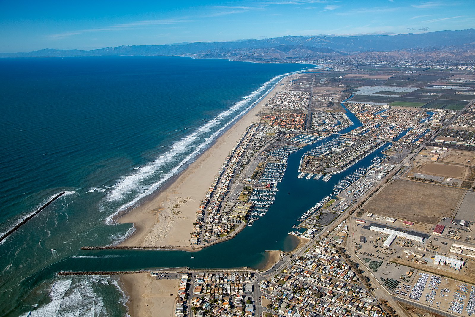
Known for its mesmerizing beaches, verdant agricultural land, and charming harbor, Oxnard, California offers infinite possibilities for stunning aerial captures. Whether you're interested in the panoramic vistas of the Pacific Ocean or the bustling Channel Islands Harbor, our aerial photography services are here to narrate your unique story.
What is Aerial Photography?
Aerial photography involves capturing images from an elevated, or bird's-eye, perspective using a camera and an aircraft. The result is a unique perspective that cannot be achieved with standard ground-level photography. Be it for advertising, real estate listings, monitoring construction progress, or mapping neighborhoods, aerial photography offers a wealth of creative possibilities.
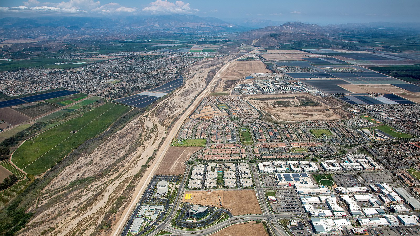
The bustling Collection at Riverpark in Oxnard, California, situated between vast stretches of agricultural land and the dry Santa Clara river, which winds its way back to the stunning mountains in the distance.
The Advantages of Aerial Photography in Oxnard
Oxnard, with its scenic beaches, lush green farms, and vibrant cityscape, is a visual treat from the sky. Whether it's showcasing waterfront properties to potential buyers or documenting agricultural farmlands, aerial photography presents an unmatched solution.
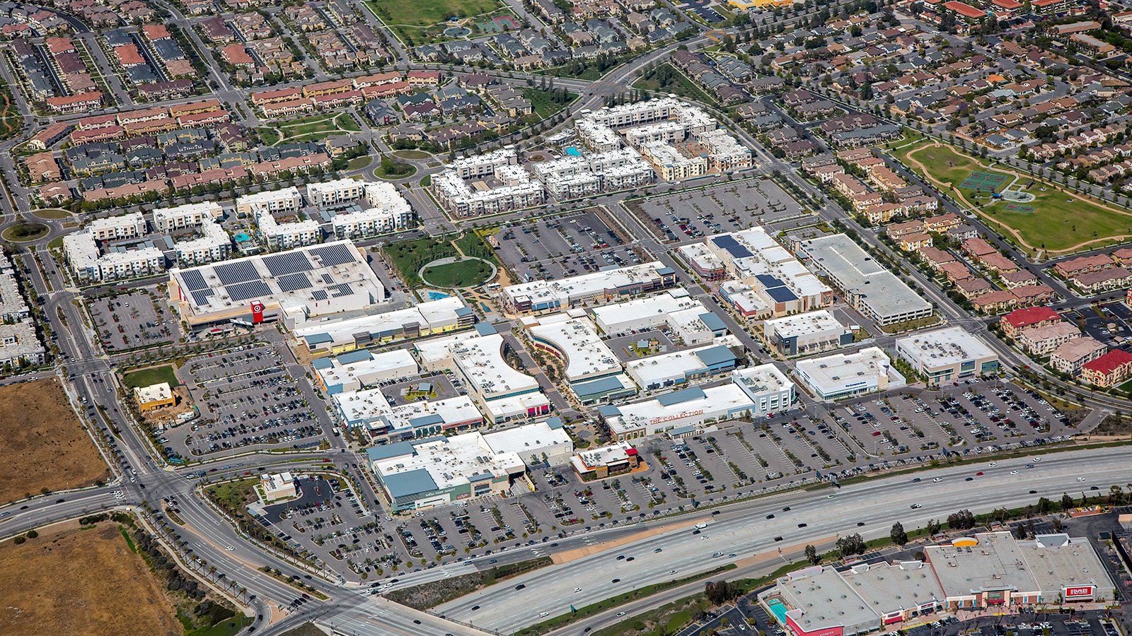
The sprawling expanse of The Collection at RiverPark Shopping Center, with its vast parking lots and surrounded by a multitude of residential apartments and housing communities.
Promoting Real Estate
Real estate agents can leverage aerial photography to enhance the visibility of the properties they have listed for sale or rent in Oxnard County. Aerial images provide a comprehensive view of large estates and their surrounding areas, offering potential buyers or renters an accurate impression of the property.
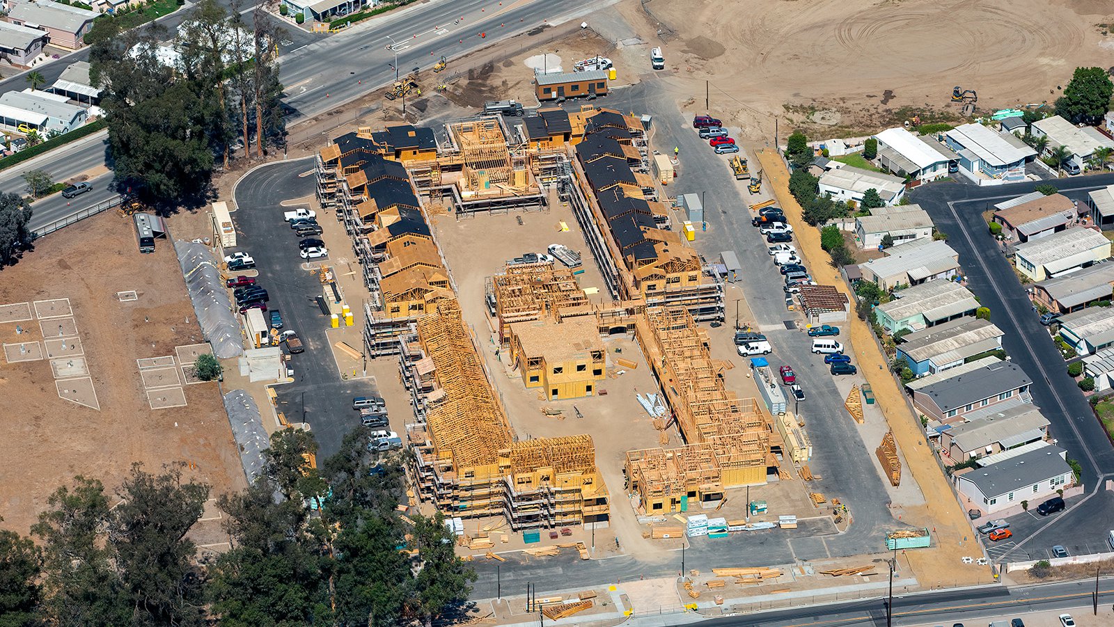
Ongoing construction of a residential apartment complex in Oxnard, California, featuring a close-up oblique view that highlights the intricate wooden framing and the dark, sleek black roofs that are being installed on a section of the building complex.
Tracking Construction Projects
Aerial photography is a valuable tool for monitoring the progress of construction projects. Regular aerial shoots can save developers time and money by providing a clear, bird's-eye view of the project's status without necessitating frequent ground-level inspections. These images can also serve as legal documentation, safeguarding the interests of developers.
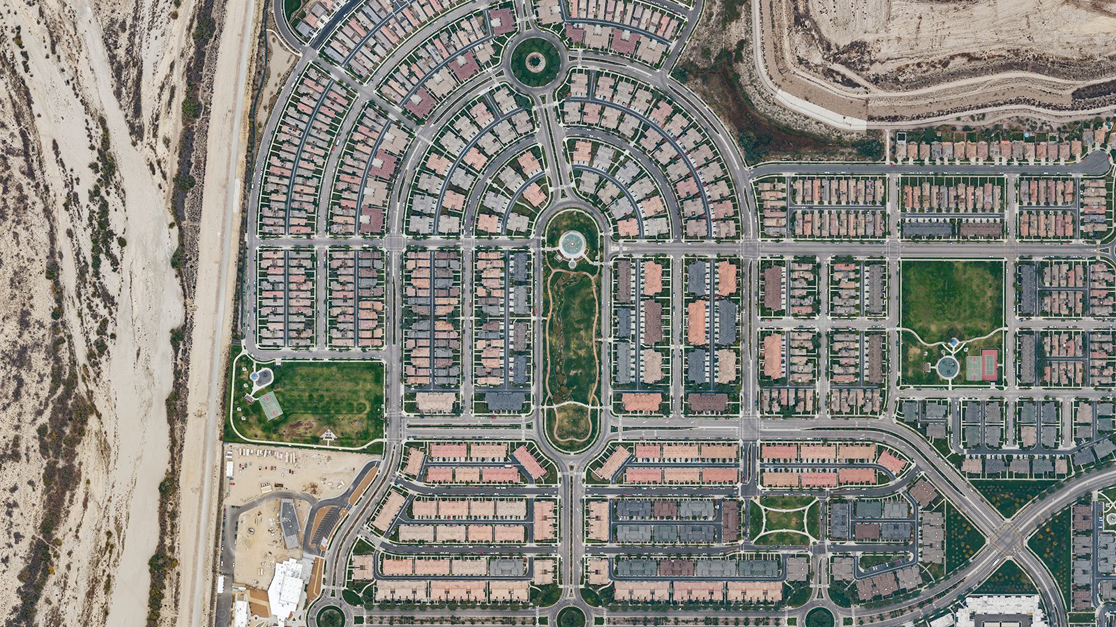
Orthophoto of the Collection at Riverpark housing communities in Oxnard, California, situated adjacent to the dry Santa Clara river on the left and boasting a sprawling green central park in the heart of the community.
Mapping Entire Neighborhoods
Aerial photography also has practical benefits like generating high-resolution maps for GIS and CAD applications. The aerial imagery of large areas like Oxnard's beach neighborhoods or agricultural lands can aid urban planning initiatives and even help service providers, such as roof repair contractors, identify potential business opportunities.
Whether you're tracking construction projects or simply want breathtaking photos of Oxnard's beautiful scenery, our aerial photography services are the ideal solution. Experience the magic of Oxnard from above with our top-notch services at West Coast Aerial Photography, Inc!
Contact Us Today
From captivating shots of the Channel Islands Harbor at sunset to overhead images revealing the patchwork beauty of Oxnard's farmland, we aim to capture the unique charm and spirit of Oxnard in each photograph we create. Contact us today and let us help you tell your story from the sky!