Lancaster, an alluring city in Southern California, is renowned for its unique blend of natural beauty and cultural landmarks. From the scenic Antelope Valley to the iconic Lancaster Boulevard, there's a myriad of narratives ready to be unveiled through aerial photography.
What is Aerial Photography?
Aerial photography involves taking photos from an elevated vantage point, primarily using a camera and an aircraft. This specialized form of photography provides unique perspectives unattainable through traditional ground-level photography. Aerial photographers utilize aircraft to seize breathtaking images of landscapes, cities, monuments and more. These images are incredibly versatile and can be used in advertising, marketing campaigns, real estate listings, and beyond. The sky is truly the limit with aerial photography!
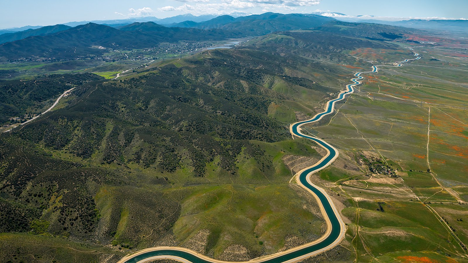
A picturesque view of the California Aqueduct, winding through vast fields of lush green vegetation and punctuated by vibrant orange California poppies, all nestled at the foot of the majestic Sierra Pelona Mountains.
The Benefits of Aerial Photography in Lancaster
Lancaster is home to some of the most picturesque landmarks and landscapes in all of California. From the bustling Lancaster Boulevard to the tranquil Antelope Valley Poppy Reserve, there's an abundance of striking visuals that can be captured through aerial photography. Whether you're aiming to market your property to potential buyers or documenting the progress of a construction project, aerial photography provides the perfect solution.
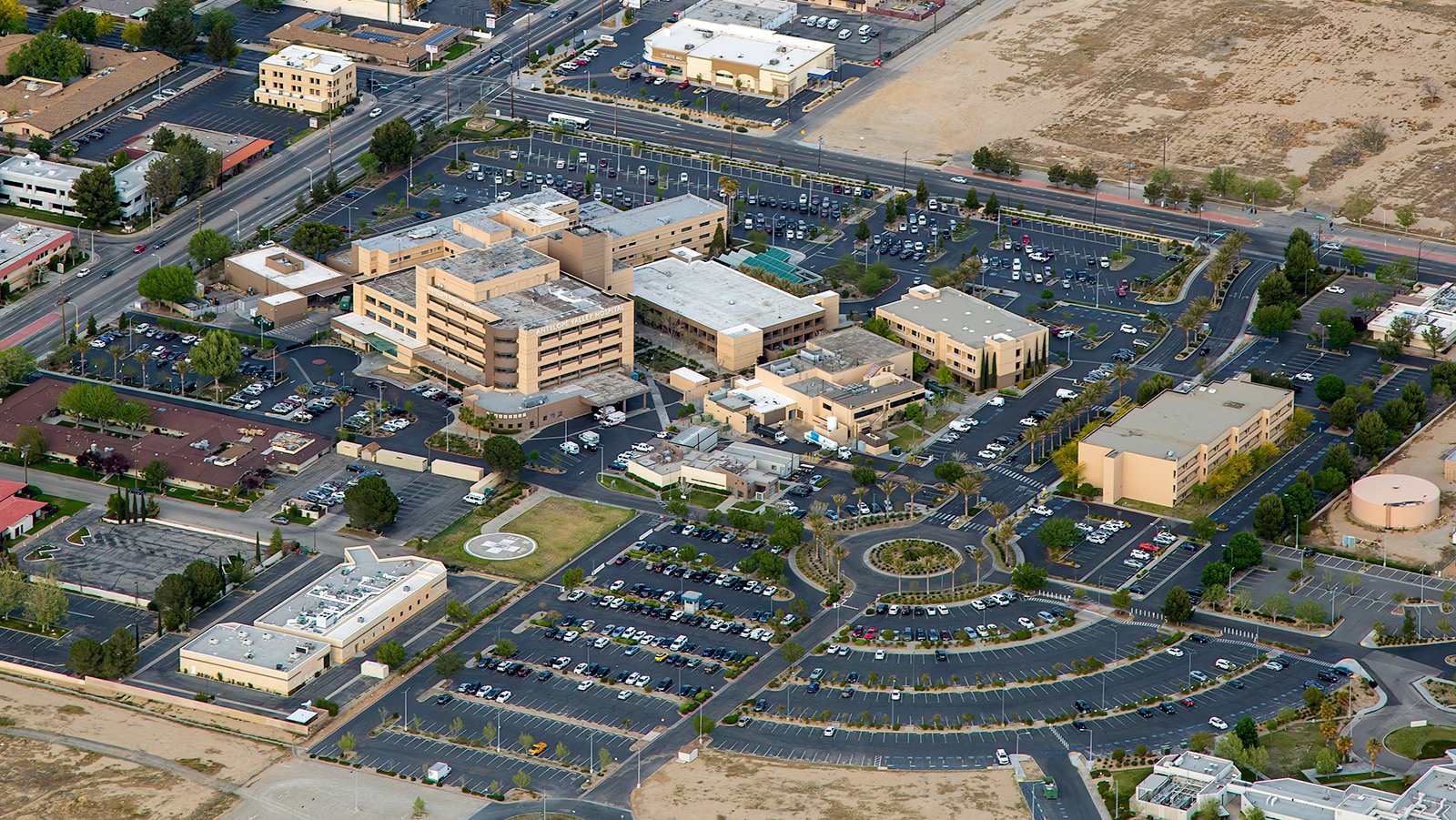
Antelope Valley Hospital, situated in the heart of Lancaster, California, boasts a range of state-of-the-art facilities and services designed to cater to the health and wellness needs of the surrounding communities.
Marketing Real Estate
Real estate agents can utilize aerial photographs to market residential or commercial properties listed for sale or rent in Lancaster County. Aerial images offer prospective buyers and renters an instant impression of the property and its surrounding area. These unique viewpoints are particularly beneficial when marketing vast properties where ground photographs cannot fully capture the enormity of the location.
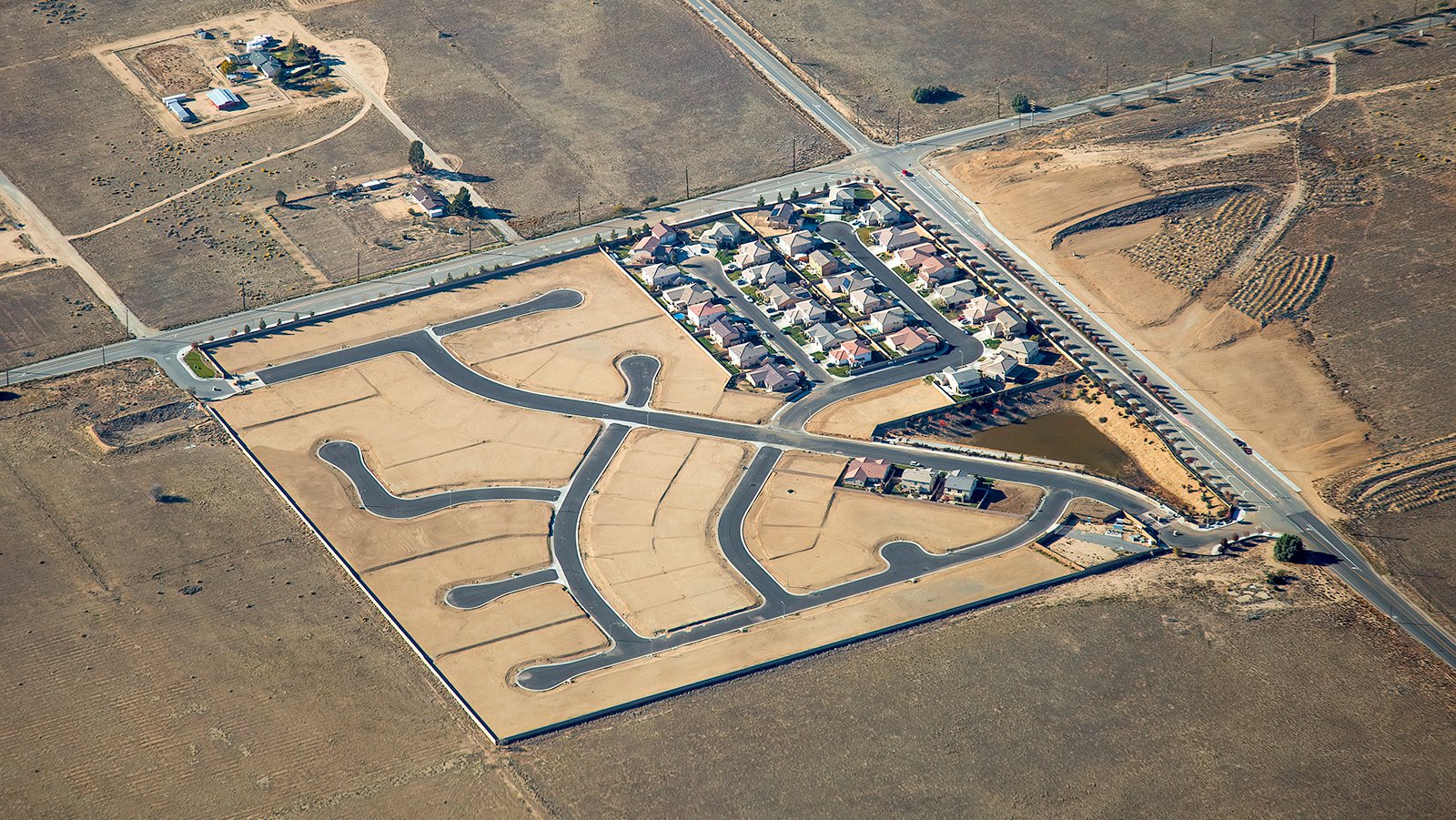
Aerial photo of the Westview Estates Housing Community shows the unfinished construction of the 425-home development, with only one corner featuring fully built homes, where ongoing legal proceedings and since-resolved water pressure issues prevented any new construction from taking place.
Monitoring Progress on Construction Projects
Aerial photography offers an efficient way to track progress on large-scale construction projects such as shopping malls, residential developments, or industrial complexes. Regular aerial photo missions can help contractors and developers monitor the progress of construction without the need for constant on-site inspections. This method can save time & money and provides an accurate visual record of the project's development over time. These historical photographs can also be referenced for insurance purposes and can be invaluable in case of legal disputes.
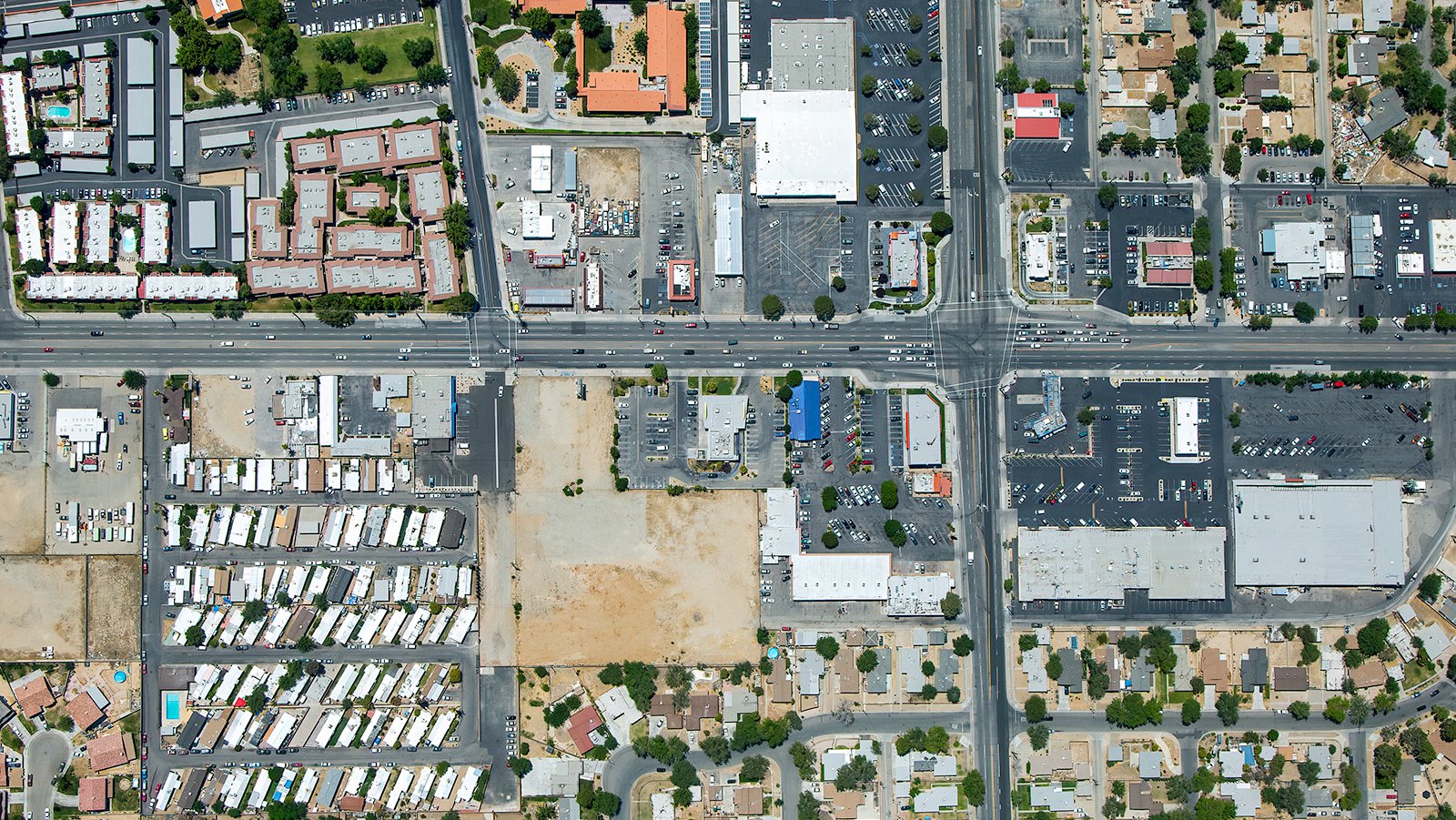
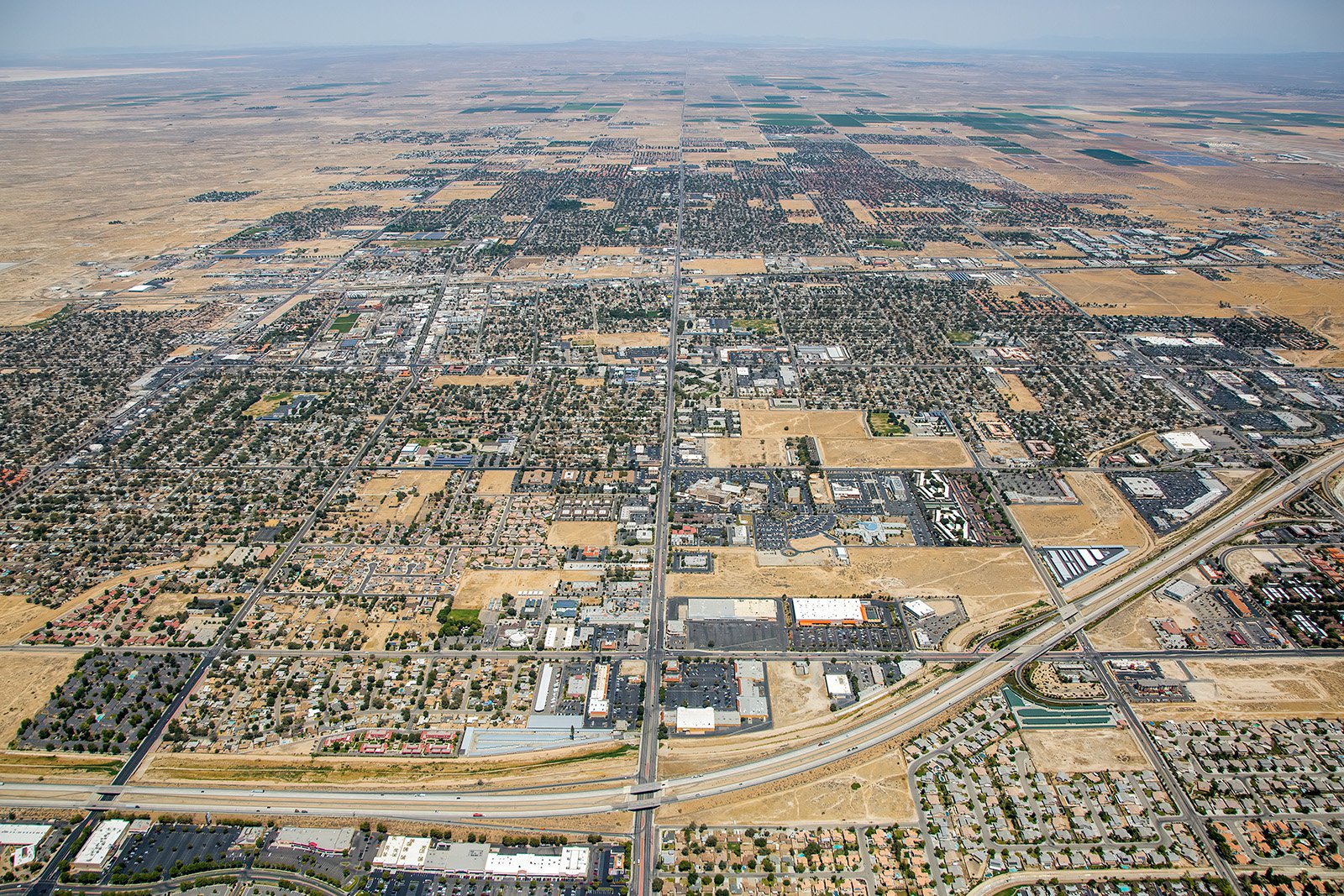
Vertical aerial photo capturing the bustling Lancaster Plaza Shopping Center, nestled amidst clusters of residential homes and towering apartment complexes, while a vast expanse of land awaits development just next to the commercial hub.
Mapping Entire Neighborhoods
Beyond offering visually captivating imagery, aerial photography also provides practical benefits. Using aircraft equipped with high-resolution cameras, large areas can be surveyed effortlessly, producing precise and high-resolution imagery for GIS and CAD purposes. These aerial photo maps can be used for planning or generating leads for contractors, for instance, roofing contractors who can easily identify roofs that require repair.

Visitors stroll along a well-marked path through the Antelope Valley California Poppy Reserve, with vibrant orange California poppies blanketing the landscape on both sides, creating a truly unforgettable and breathtaking scene.
If you're seeking stunning aerial photographs of Lancaster's unique landscape or want to keep a close eye on your construction project's progression, aerial photography is the ideal solution! For the best aerial photography services in Lancaster, California, choose West Coast Aerial Photography, Inc!
Get in Touch Today
From mesmerizing shots of the Antelope Valley California Poppy Reserve to riveting images of the lively Lancaster Boulevard, we aim to encapsulate the unique charm and essence of Lancaster in every photo we take.