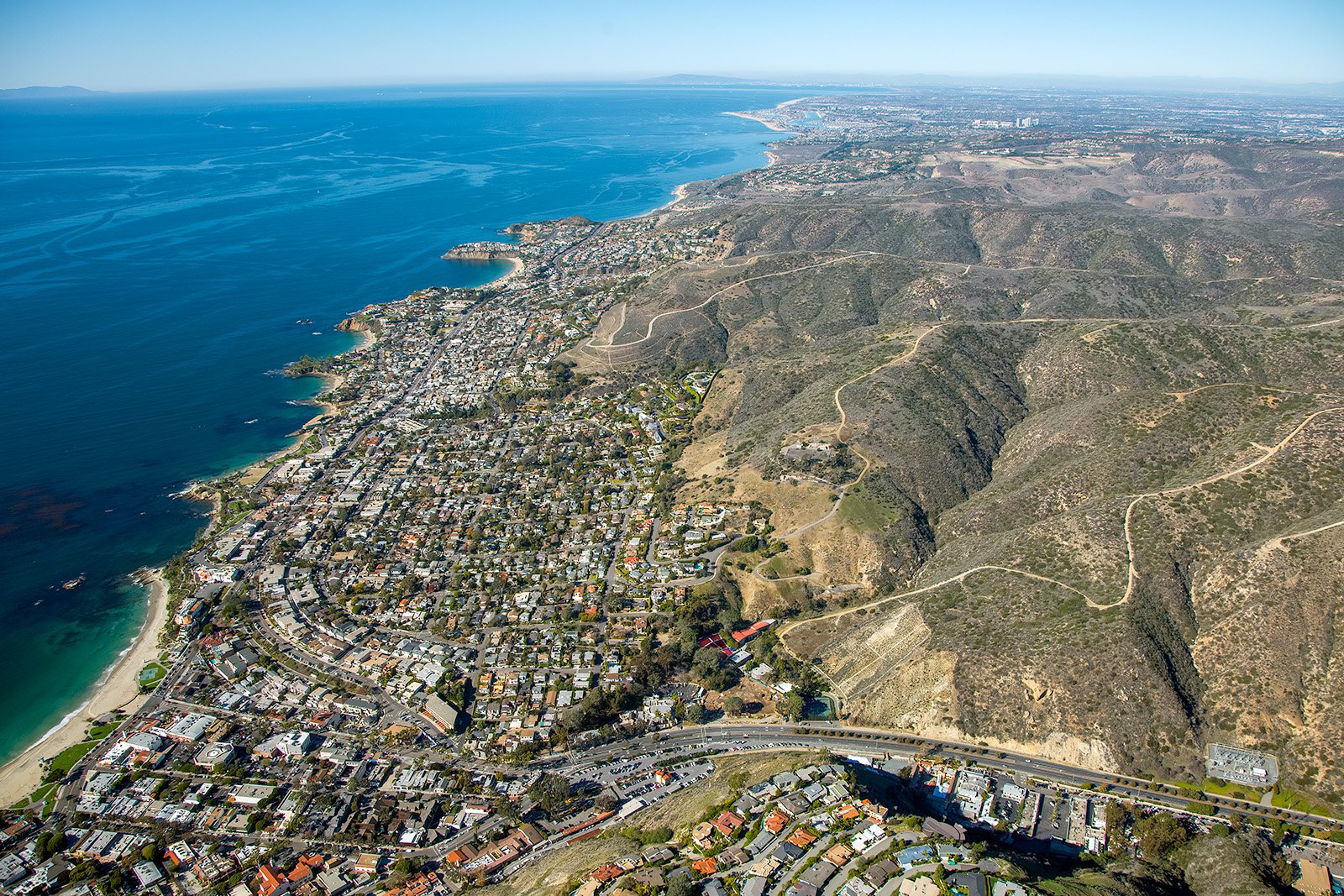
Laguna Beach, famous for its mild year-round climate, scenic beaches, and artist community, is a picturesque location with a myriad of narratives that only aerial photography can adequately narrate.
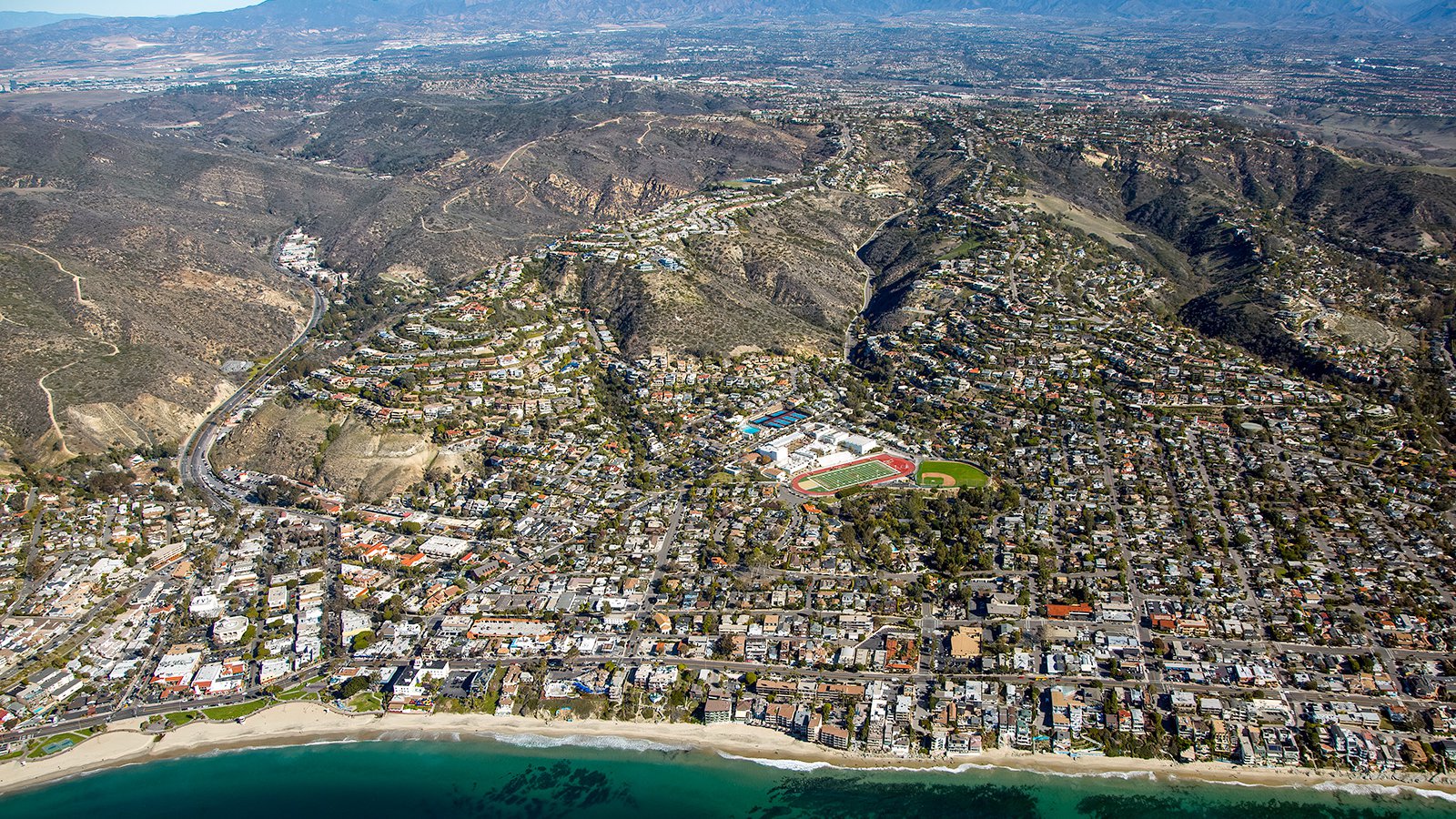
Laguna Beach High School sits admidst the vibrant cityscape of Laguna Beach, viewed from above the serene waters of the Pacific Ocean.
What is Aerial Photography?
Aerial photography involves capturing photographs from an elevated perspective, typically using a camera and an aircraft. This unique form of photography provides angles and views that traditional terrestrial methods cannot replicate. From real estate marketing to progress monitoring of construction projects, aerial photography unlocks endless creative possibilities, providing comprehensive views of landscapes, cityscapes, monuments, and more.

Aerial view of residential beachfront homes lining the serene shores of Laguna Beach, California, overlooking beachgoers enjoying the picturesque, sandy beaches.
The Benefits of Aerial Photography in Laguna Beach
Laguna Beach offers a diverse array of spectacular landscapes, from the famous Main Beach Park to the renowned art galleries of Laguna Village. Whether you're highlighting a beachfront property for potential clients or documenting a construction project at the beautiful Laguna Canyon, aerial photography offers an unrivaled solution.
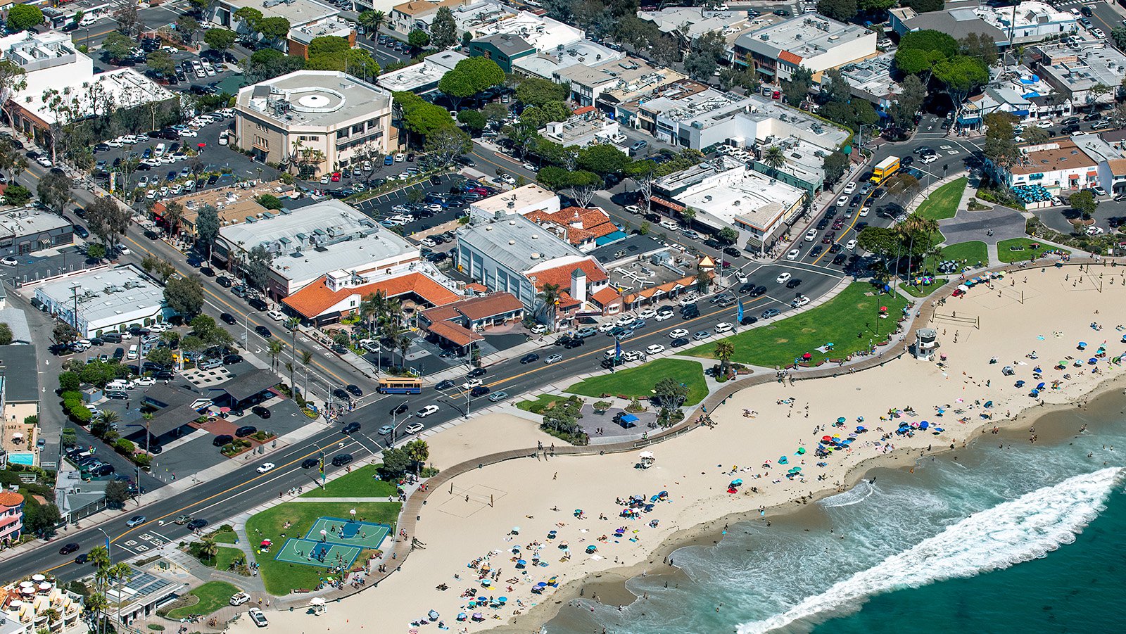
Shopping and leisure blend seamlessly across from Main Beach Park, set in the heart of Laguna Beach’s vibrant community.
Marketing Real Estate
Laguna Beach real estate agents can benefit significantly from aerial photographs when they're marketing residential or commercial properties for sale or rent. Aerial photography provides potential buyers and renters a comprehensive perspective of the property, its surroundings, and proximity to local landmarks like the Pacific Marine Mammal Center. This is especially beneficial when showcasing large properties where ground photographs cannot capture the full extent.
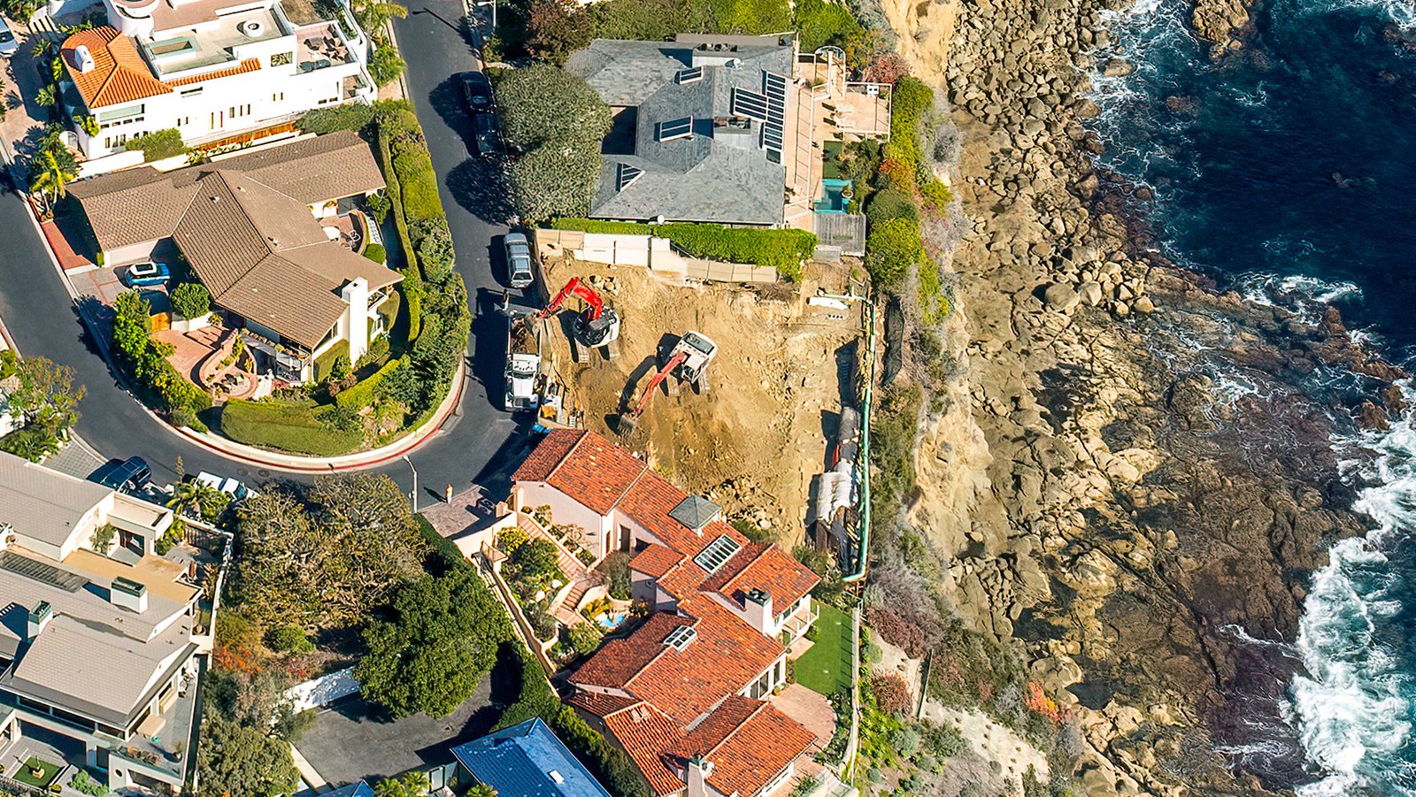
A residential property under construction perched atop the scenic bluffs overlooking Laguna Beach’s coastline.
Monitoring Progress on Construction Projects
For large scale construction work such as the development of new resorts or renovations of historic buildings, regular aerial photography can be instrumental in monitoring progress. Through periodic aerial shoots, contractors can keep track of progress without the need for frequent on-site visits. These photographs can also serve as historical records, potentially saving time and money in potential future legal disputes.

Engineering-grade orthophoto of Laguna Beach, California in its entirety, from serene beaches to rolling hills.
Mapping Entire Neighborhoods
Aerial photography extends beyond just stunning visuals; it also has practical applications. Photographers using high-resolution cameras can efficiently survey larger areas, creating precise and high-resolution images for GIS and CAD applications. These aerial maps can be used for planning or generating leads for contractors - like identifying homes that might require roof repairs.
Whether you need to monitor your construction project's progress, market a sprawling estate, or want striking photographs that capture Laguna Beach's unique beauty, aerial photography is the perfect solution!
Laguna Beach, with its stunning landscapes and vibrant community, offers unparalleled opportunities for exceptional aerial photography. For aerial photography services in Laguna Beach, reach out to us at West Coast Aerial Photography, Inc.!
Get in Touch Today
From the breathtaking sunsets at Thousand Steps Beach to the vibrant atmosphere of downtown Laguna Beach, we aim to encapsulate the unique spirit and charm of Laguna Beach in each photograph we create.