Known for its picturesque landscapes, Hesperia, California offers a unique blend of urban and natural vistas, from the Mojave River to the bustling Main Street, waiting to be captured through the lens of an aerial photographer.
What is Aerial Photography?
Aerial photography is an innovative technique of capturing images from an elevated position, typically using a camera and an aircraft. A unique approach that has revolutionized the way we look at landscapes and cityscapes, aerial photography provides unmatched perspectives that traditional ground-level photography cannot. This technique is widely adopted in marketing, real estate, mapping, and more, taking creativity to new heights.
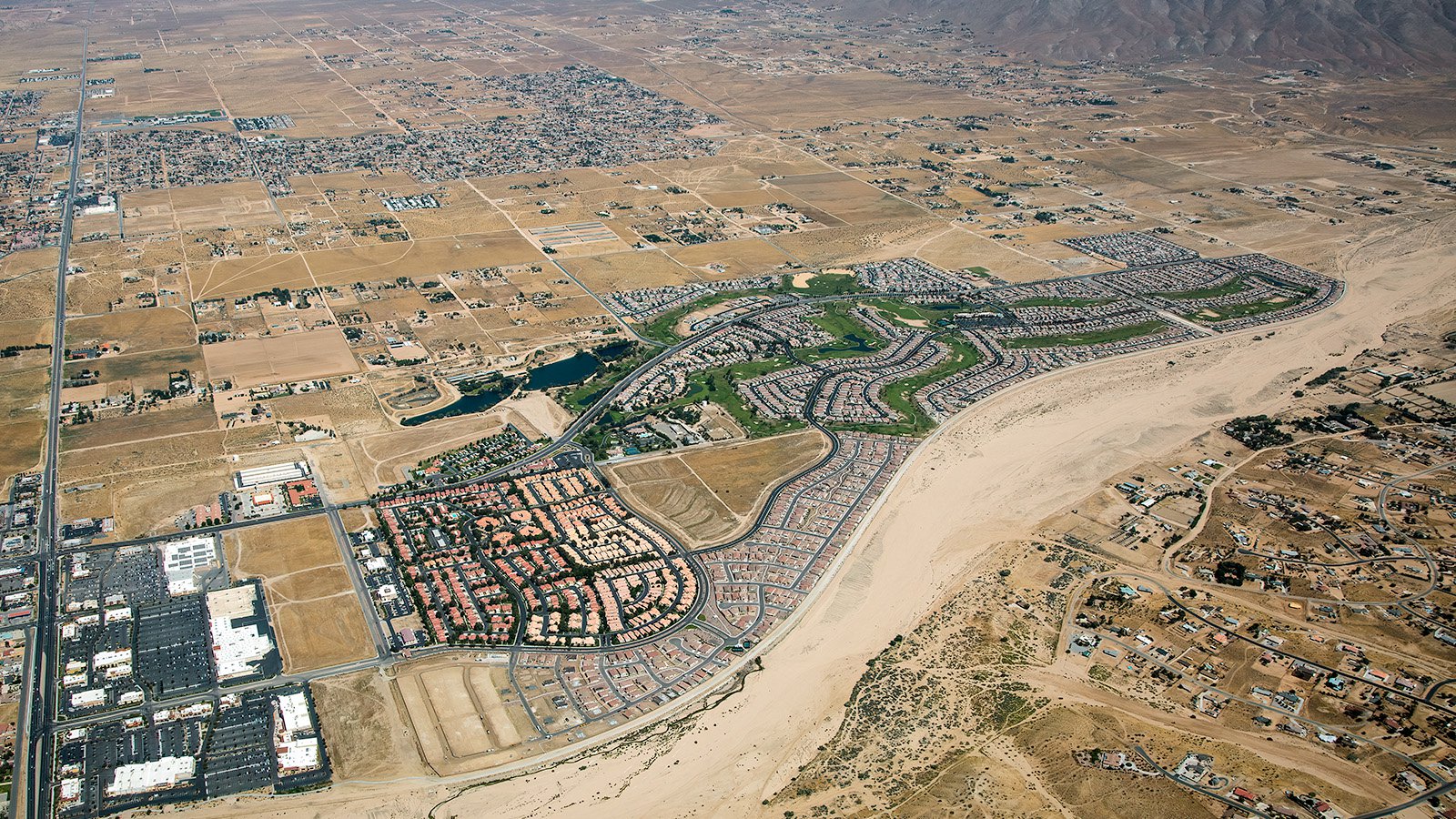
The 27-hole Ashwood Golf Course, nestled in the California High Desert in Hesperia, California
The Benefits of Aerial Photography in Hesperia
Hesperia, with its sprawling desert landscapes and urban pockets, offers an extraordinary canvas for aerial photography. Whether you are looking to showcase your property to potential buyers, or document a construction project, aerial photography provides the optimal solution. From the mesquite-rich Mojave Riverbed to the lively commercial hub on Main Street, aerial images can help capture the diversity and charm of Hesperia's landscapes.
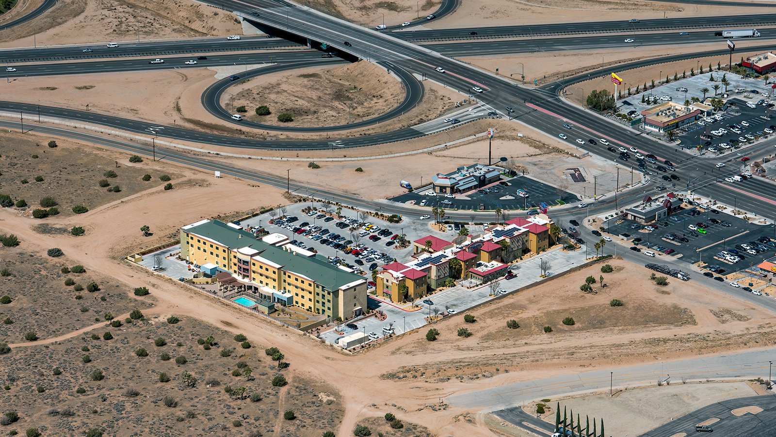
The Courtyard Marriott and Springhill Suites Marriott in Hesperia, California, located just off the I-15, are within easy reach of an number of popular attractions such as Big Bear and Silverwood Lake.
Real Estate Marketing
Aerial photography is a powerful tool for real estate agents marketing properties in Hesperia. It offers potential buyers a comprehensive view of the property and its surroundings, which is particularly beneficial for large properties where ground-level photographs may not do justice. From sprawling ranches to commercial listings on Bear Valley Road, aerial photographs can significantly enhance your marketing efforts.
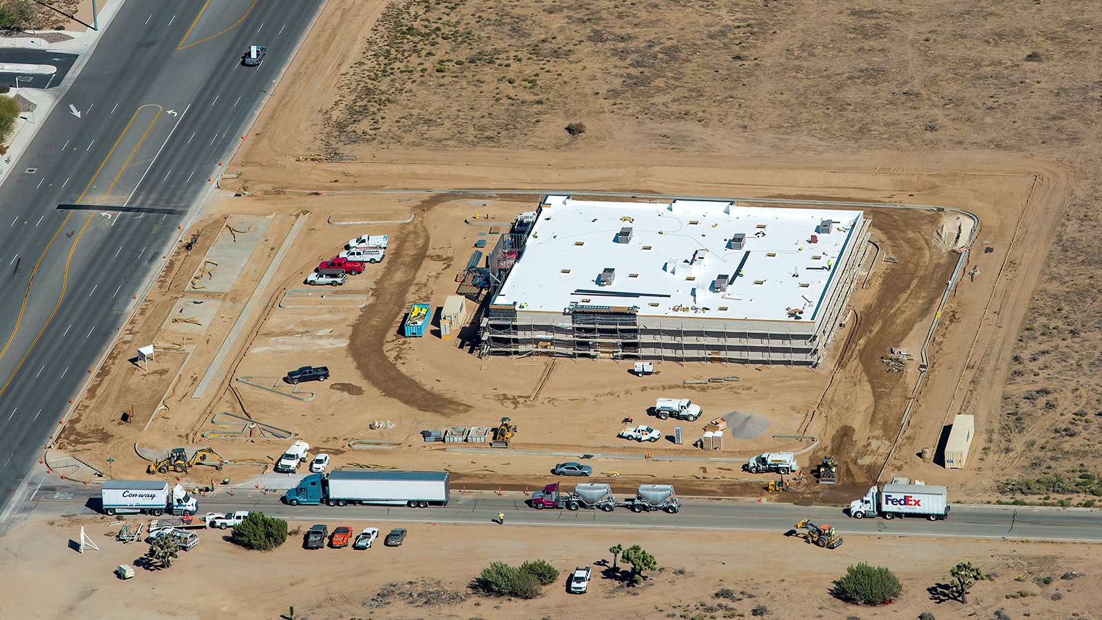
Ongoing construction of a new Tractor Supply store in Hesperia, California, which will provide the community with a comprehensive selection of rural lifestyle products, including pet supplies, power equipment, work wear, and livestock feed.
Construction Project Monitoring
Aerial photography also proves beneficial in tracking progress on construction projects. Regular aerial shoots can provide developers and contractors with a bird's eye view of the project, helping them monitor progress over time without in-person inspections. This method is both cost-effective and efficient, providing a visual narrative of the project’s development. This imagery can also serve as a useful reference for insurance or legal purposes.
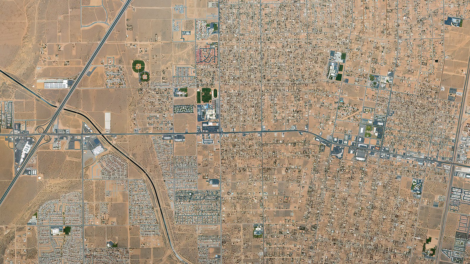
Orthophoto of Hesperia, California showing the vast expanse of the city's landscape, highlighting its abundant natural beauty, vibrant community spaces, and commercial development.
Neighborhood Mapping
Aerial photography can also be used to generate high-resolution maps of large areas, serving practical purposes such as planning or generating leads for contractors. For instance, high-resolution imagery can help roofing contractors identify roofs that require repair or replacement.
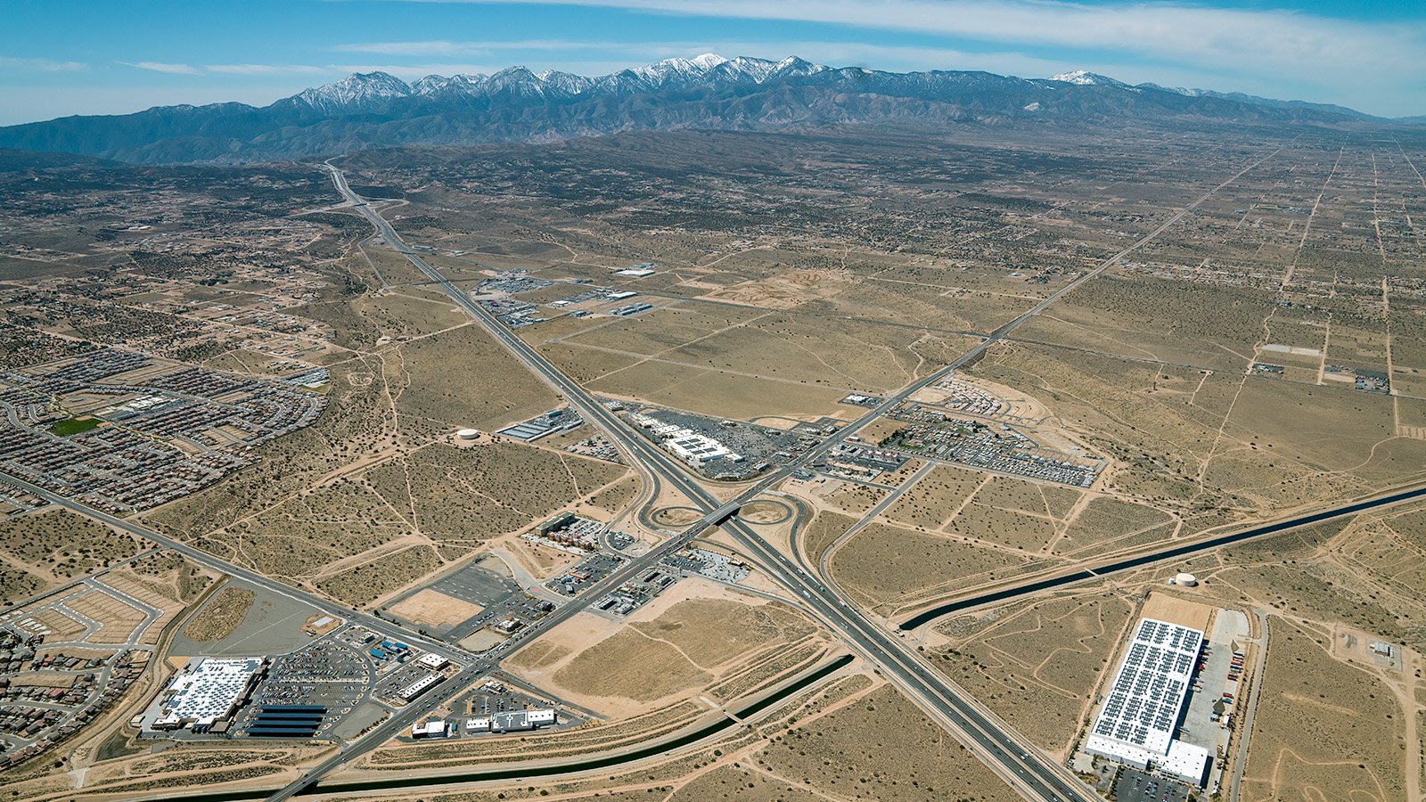
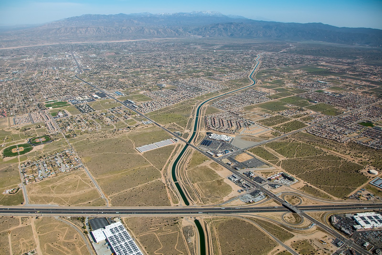
Aerial cityscape capturing the unique and picturesque blend of Hesperia's high desert with snow-capped mountains in the background
Whether you want to monitor the progress of a construction project, need high-quality images for real estate marketing, or simply want to capture the stunning beauty of Hesperia, our aerial photography services are here to help!
Contact Us Today
Capture the enchanting views of the High Desert or the panoramic image of Hesperia Lake Park with our expert aerial photography. We are committed to bringing out the true essence of Hesperia in every image we capture. Get in touch with us today!