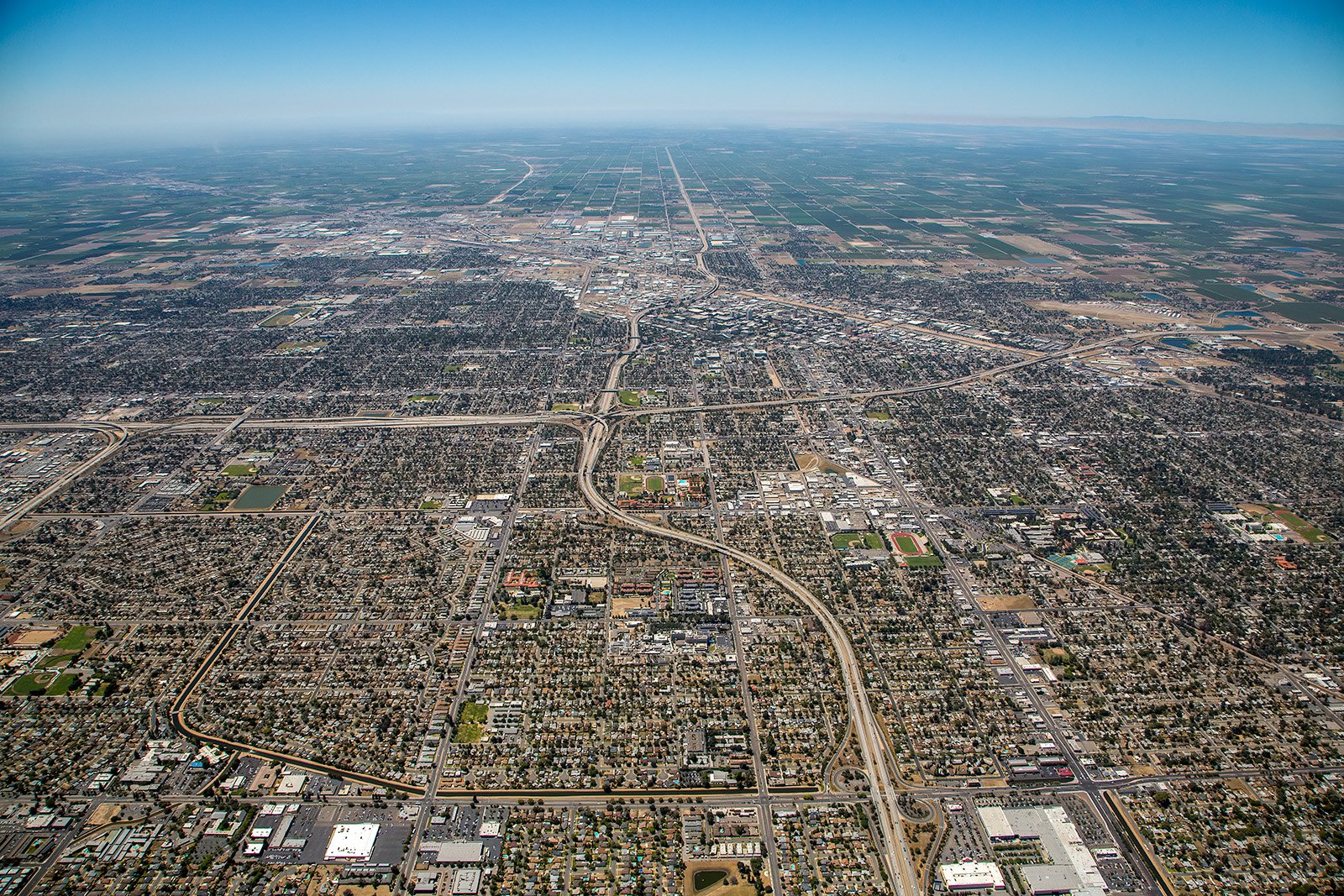
Fresno, nestled in the heart of California's San Joaquin Valley, is packed full of unique landscapes and urban structures. From the lush vineyards of the surrounding wine country to the historic architecture of downtown Fresno, aerial photography can bring these remarkable sights to life.
What is Aerial Photography?
Aerial photography involves capturing images from a high vantage point, typically from an aircraft. This distinct form of photography provides uncommon perspectives that can enhance the allure of any subject matter. Aerial photographers use specialized equipment to create captivating images of landscapes, cityscapes, landmarks, and more, ideal for promotional materials, real estate listings, or general artistic expression. The sky isn't just the limit with aerial photography—it's the platform.
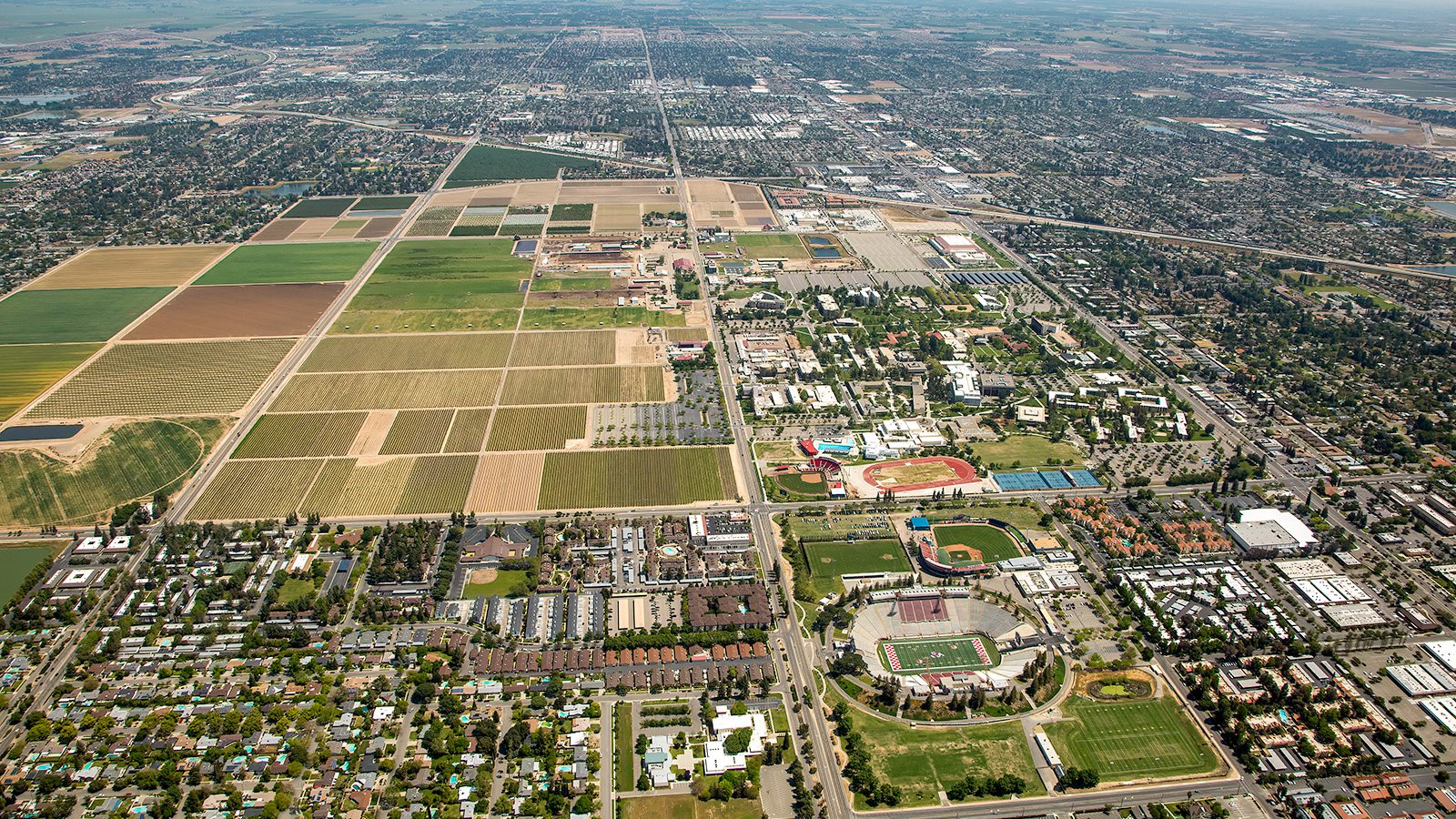
Oblique aerial photo of California State University, Fresno showing the sprawling campus situated in the heart of the San Joaquin Valley, surrounded by agricultural fields and framed by the majestic Sierra Nevada mountain range.
The Benefits of Aerial Photography in Fresno
Fresno, known for its agricultural richness and vibrant urban heart, offers a myriad of opportunities for spectacular aerial photography. Whether you're highlighting a commercial property for potential investors or documenting progress on an infrastructure project, aerial photography can be your perfect companion.
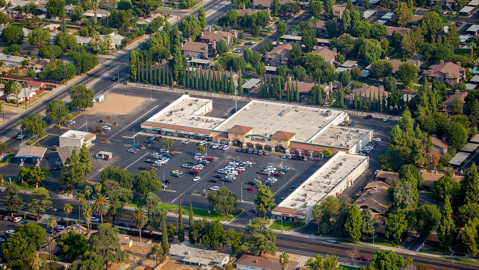
Aerial view of Sunnyside Shopping Center in Fresno, CA, with a Vallarta Market serving as the main anchor and a variety of other stores existing within the complex.
Marketing Real Estate
Aerial photography can be a game-changer for real estate agents in Fresno County. Properties surrounded by the lush vineyards, or located in the heart of the city, can be showcased effectively using aerial shots. This kind of photography offers potential buyers an overview of the property as well as its surrounding areas, enhancing the appeal and providing a unique marketing perspective.
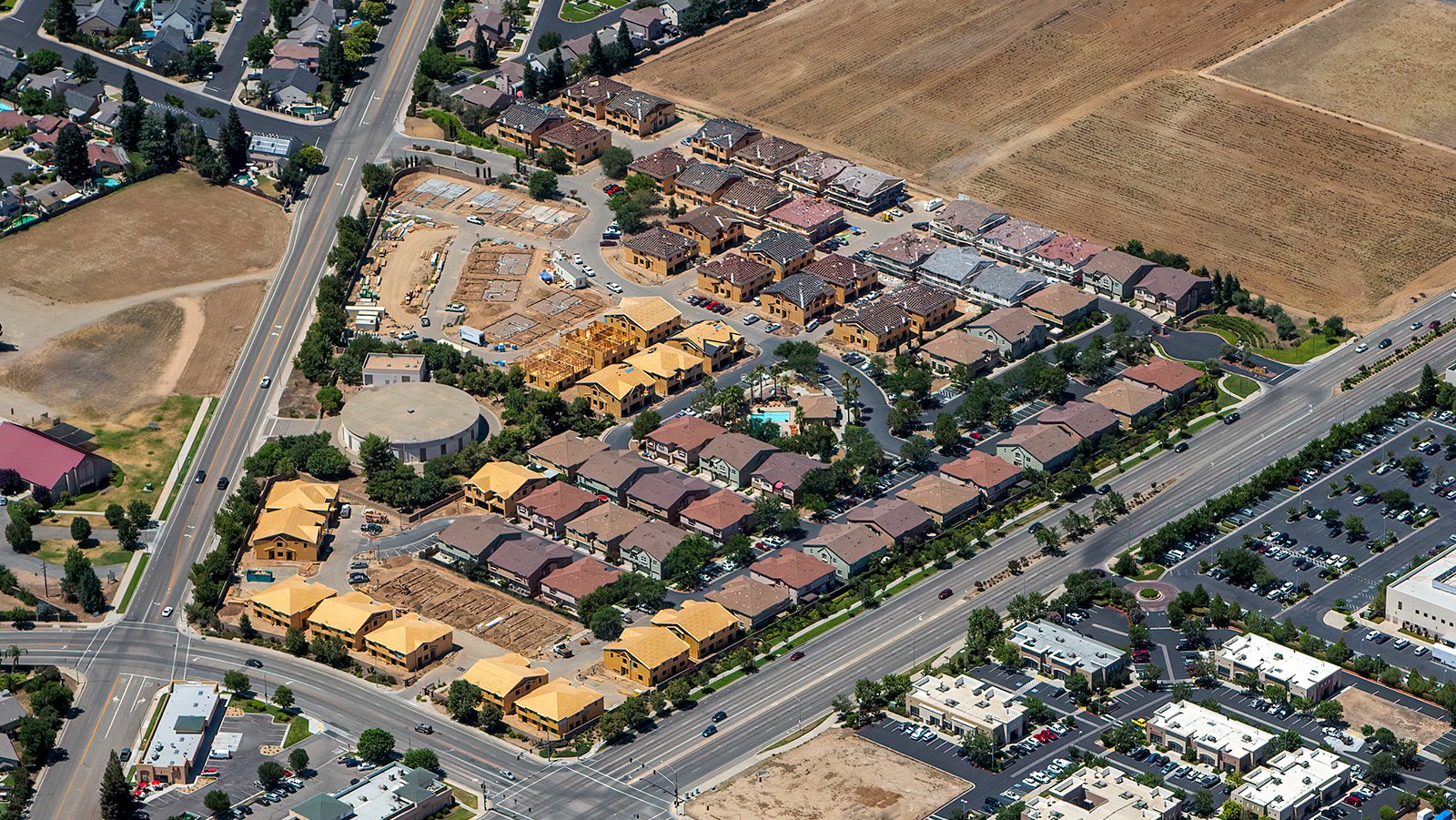
Aerial photograph capturing the progress of a housing community in Fresno, California, showcasing a range of construction phases from excavated dirt to fully-constructed homes.
Monitoring Progress on Construction Projects
Aerial photography is an excellent tool for monitoring large-scale construction projects such as suburban developments, shopping centers, or industrial parks. Regular aerial photoshoots allow contractors and developers to track their project's progress over time without the need for constant on-site inspection, saving time and resources. These images also become a valuable record for future reference in case of legal or insurance issues.
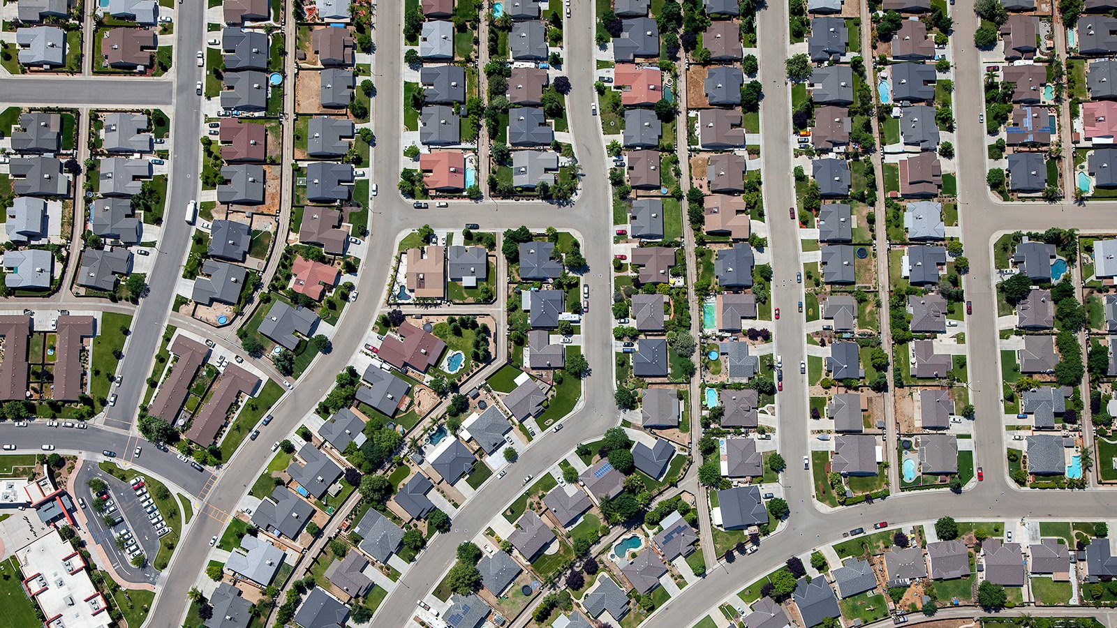
Vertical aerial photo of a sprawling residential area of Fresno, California, showcasing varied architectural styles and neatly arranged streets.
Mapping Entire Neighborhoods
Beyond its aesthetic appeal, aerial photography has practical applications too. High-resolution cameras fitted on aircraft can survey vast expanses, producing precise high-resolution imagery for GIS and CAD purposes. These aerial maps can aid planning initiatives or help identify potential business leads—for instance, roofing companies can spot roofs that require repair.
Whether you're documenting your development project, marketing real estate properties, or capturing the characteristic charm of Fresno for a wall feature, aerial photography provides a unique and stunning solution! Trust Mark & Steven at West Coast Aerial Photography for top-quality aerial photographic services in Fresno.
Get in Touch Today
From the picturesque landscapes of the San Joaquin Valley and the Fresno Chaffee Zoo to the iconic Fresno Water Tower, we aim to encapsulate the vibrant essence of Fresno in every image we capture.