Dana Point, a stunning coastal city known for its unique surf culture, charming harbor, and breathtaking cliffs, offers an array of captivating visuals. From the shoreline of Doheny State Beach to the renowned Dana Point Headlands, our aerial photography captures the essence and allure of this seaside community.
What is Aerial Photography?
Aerial photography involves taking pictures from an elevated position, typically from an aircraft. This specialized form of photography allows for capturing unique angles and perspectives that are not possible with conventional ground-level photography. Aerial photographers use aircraft to capture exceptional images of landscapes, cities, landmarks, etc., for use in various applications like advertising, marketing campaigns, real estate listings, and more. With aerial photography, the sky is the limit to your creative potential.

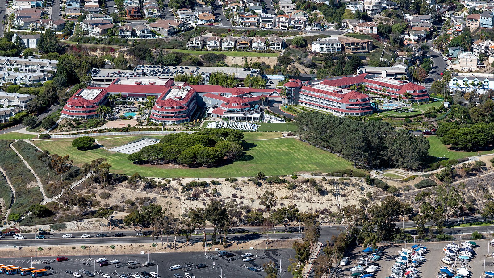
The sprawling and luxurious Laguna Cliffs Marriot Resort & Spa hotel in Dana Point, California, featuring stunning panoramic views, spacious outdoor pools, multiple restaurants and bars, and a variety of recreational and wellness facilities.
The Benefits of Aerial Photography in Dana Point
Dana Point, with its scenic beaches, marina, and luxury residential areas, offers numerous opportunities for stunning aerial photography. Whether you’re showcasing your property to prospective buyers or wish to chronicle the progress of a construction development, aerial photography offers an impressive solution.

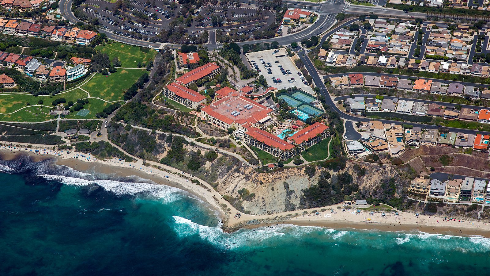
Aerial photo of the magnificent Ritz Carlton resort perched on a picturesque coastal bluff in Dana Point, California, offering stunning panoramic ocean views and surrounded by bustling beaches dotted with sun-seeking beachgoers.
Real Estate Promotion
Real estate agents can effectively utilize aerial photographs to market residential or commercial properties listed for sale or lease in Dana Point. Aerial images provide potential buyers and tenants with a comprehensive view of the property and its surrounding areas, especially beneficial for large properties where ground photographs may not adequately represent the location.

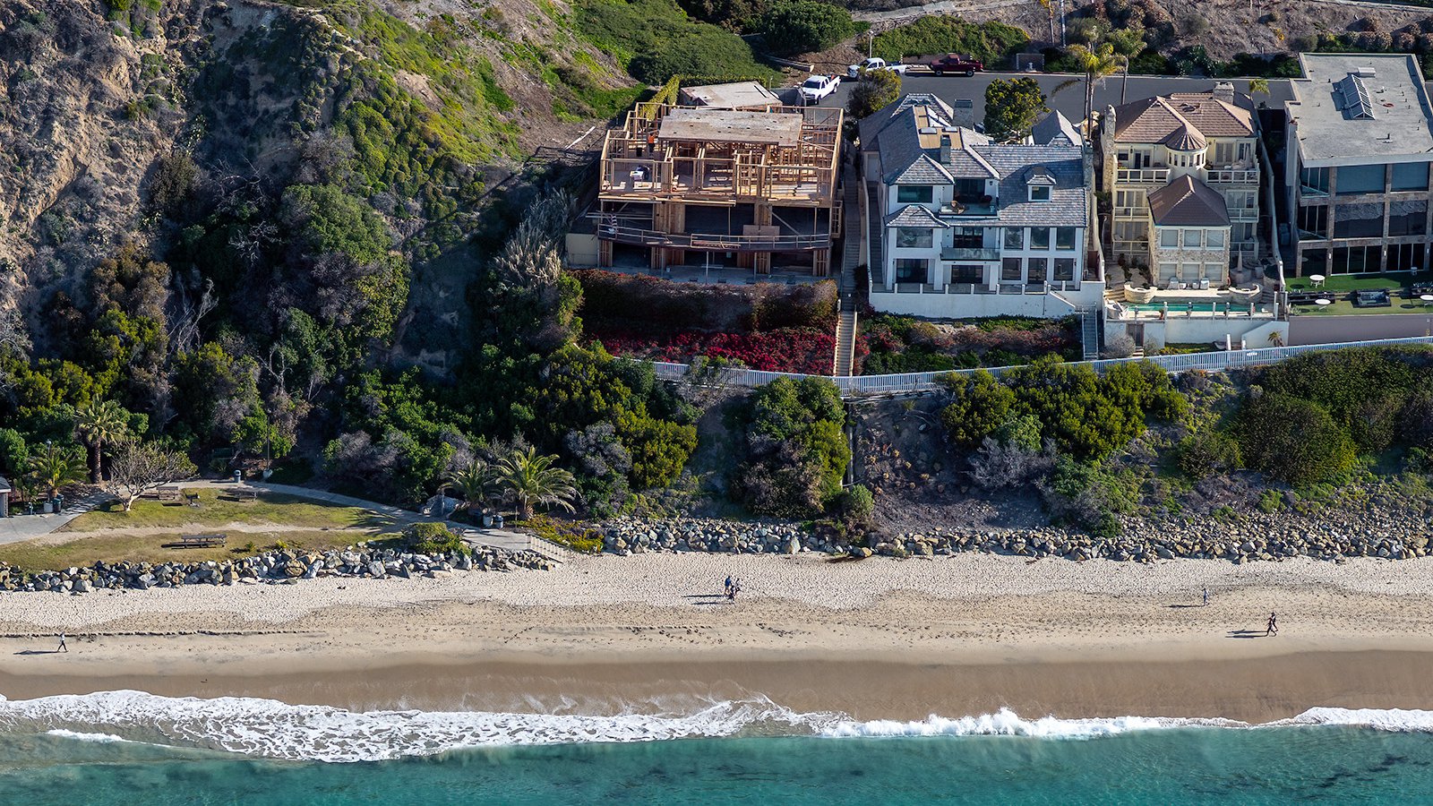
An oceanfront home in Dana Point, California currently under construction, with commanding views of the Pacific Ocean.
Tracking Construction Projects
Aerial photography is also invaluable for monitoring progress of both small and large-scale construction projects, such as residential subdivisions, commercial buildings, or marina developments. Regular aerial photo shoots allow contractors and developers to track progress without constant on-site visits, saving time and resources while providing a precise record of the project's development over time. These images may also serve as valuable references for insurance or legal matters.

Vertical aerial view showing the organized layout of a Dana Point residential neighborhood, with clearly defined cul-de-sacs and ample communal green space for residents to enjoy.
Mapping Coastal Communities
The practical benefits of aerial photography extend beyond visual appeal. Using high-resolution cameras on aircraft, large areas can be surveyed accurately, creating high-definition imagery for GIS and CAD applications. These aerial photo maps can be used for planning purposes or to generate leads for contractors, such as identifying roofs requiring repair in coastal communities.
Whether you’re monitoring the progress of your marina development, or seeking captivating images of Dana Point's unique landscapes, aerial photography is your ideal solution! For the best aerial photography services in Dana Point, get in touch with Mark and Steven at West Coast Aerial Photography, Inc.!
Contact Us Today
From capturing the vibrant energy of Doheny State Beach to framing the sunset over the cliffs of Dana Point Headlands, we aim to encapsulate the unique charm and beauty of Dana Point in every snapshot we create.