Located at the border between California and Mexico, Calexico is a city rich in cultural diversity and history. Our aerial photography captures the unique blend of architectural styles, the enchanting desert landscapes, and the vibrancy of life in Calexico.
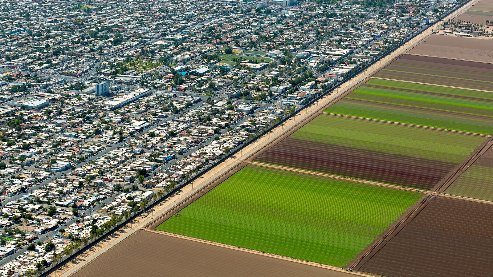
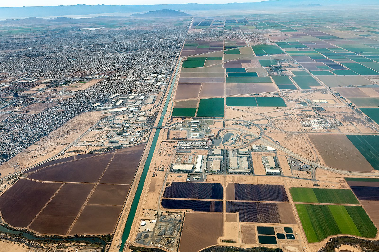
Aerial photograph showing the stark contrast between the agricultural expanses of Calexico and the densely populated urban sprawl of Mexicali, with the US-Mexico border cutting through the center of the image.
What is Aerial Photography?
Aerial photography captures images from a high position, typically from an aircraft, offering a perspective that ground-level photography simply cannot provide. It offers a comprehensive view of landscapes, cityscapes, and landmarks, for advertising, marketing campaigns, real estate listings, and more. Aerial photography offers endless creative possibilities.
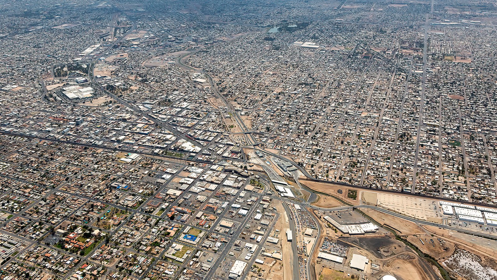
Calexico West Port of Entry, which serves as a vital gateway for commercial and industrial trade between the United States and Mexico, with the bustling city of Mexicali visible across the US-Mexico border.
The Benefits of Aerial Photography in Calexico
Calexico, with its historical landmarks such as the Gran Plaza Outlets and the Imperial Valley Desert Museum, presents numerous captivating visuals. Aerial photography is ideal whether you aim to showcase your property to potential buyers or document a construction project.
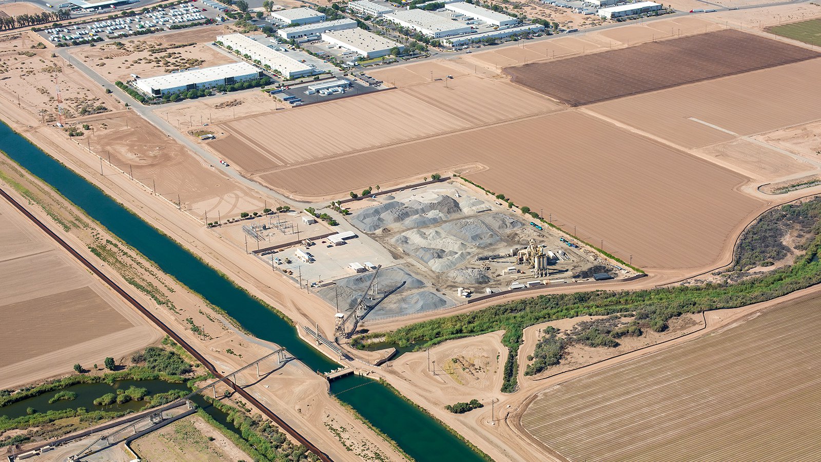
Detailed aerial view of the Aggregate Products asphalt mixing plant in Calexico, California, which forms a crucial part of the city's industrial sector, contributing to the region's economic growth and development.
Marketing Real Estate
In a dynamic city like Calexico, aerial photography can be a game-changer for real estate agents who are marketing residential or commercial properties. It provides an overhead view of the property and its surroundings, offering an perspective that ground photographs cannot capture.
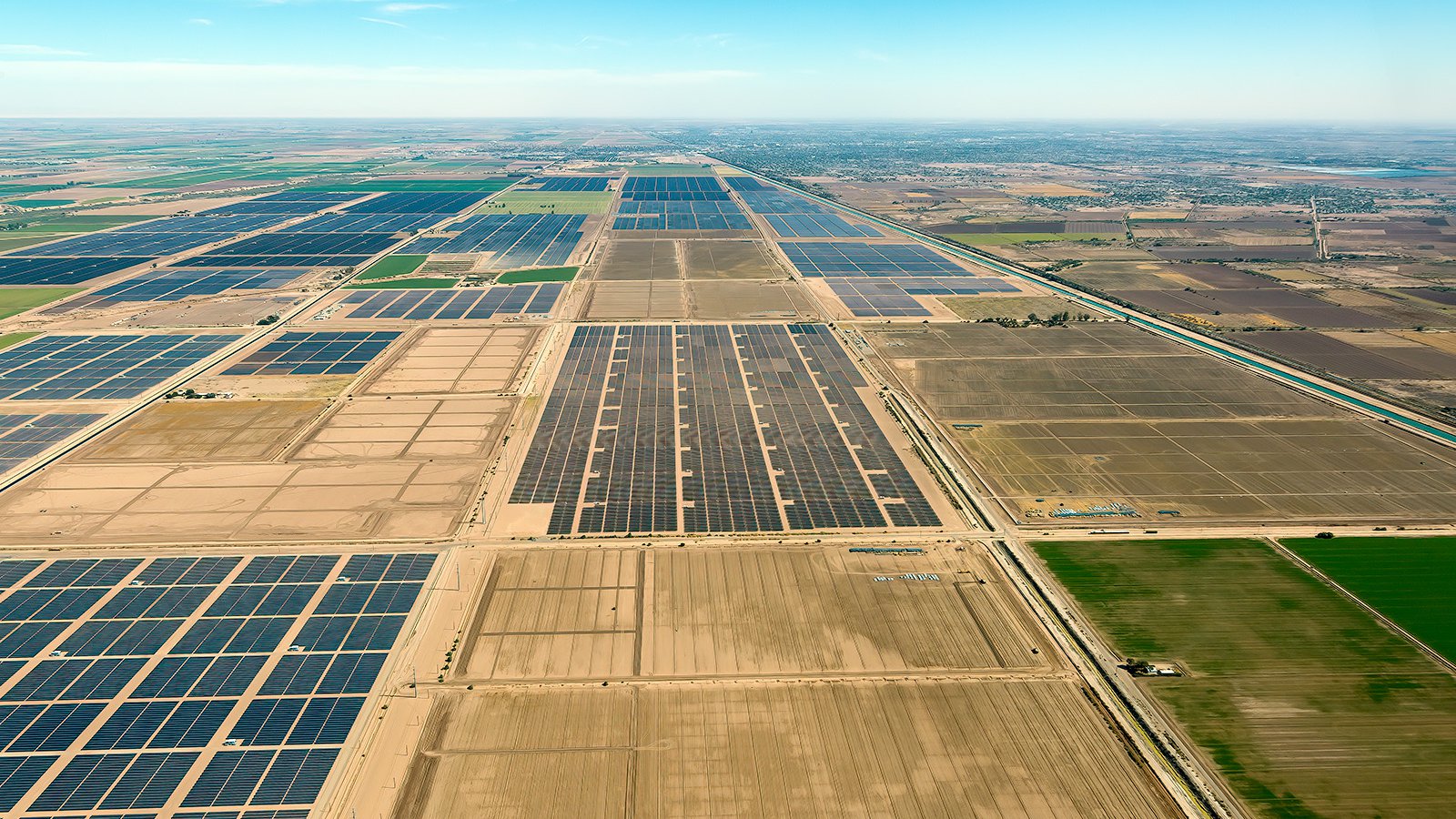
Aerial photo capturing the contrast between the fully operational Mount Signal solar farm and the ongoing construction of numerous other large-scale solar facilities in Calexico, California.
Monitoring Progress on Construction Projects
Aerial photography is also ideal for tracking progress on construction projects. Regular aerial photographs provide a clear picture of the project's development over time, without the need for constant on-site inspection. These photographs can also serve as a reference for insurance purposes, potentially saving developers time and money in case of legal disputes.
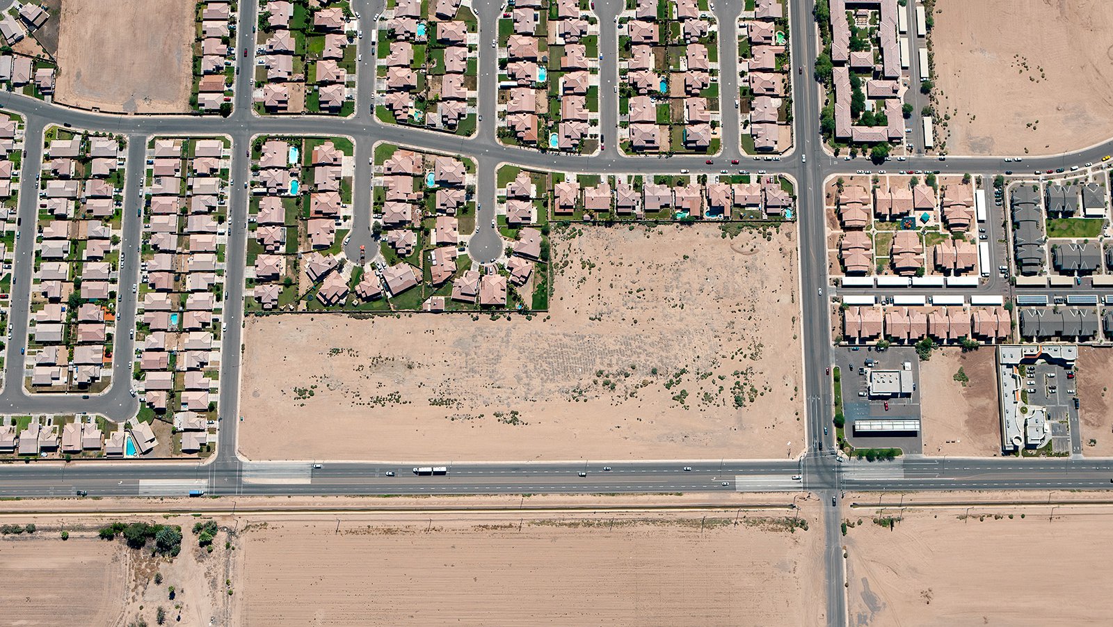
Vertical, straight-down aerial view of Calexico, California presents an empty block of land awaiting developed, situated in the midst of flourishing residential communities.
Mapping Entire Neighborhoods
Harnessing the power of high-resolution cameras mounted on airplanes, aerial photography can efficiently survey large areas, generating accurate imagery for GIS and CAD purposes. These aerial photo maps can be used for planning or as a tool for contractors to identify potential leads.
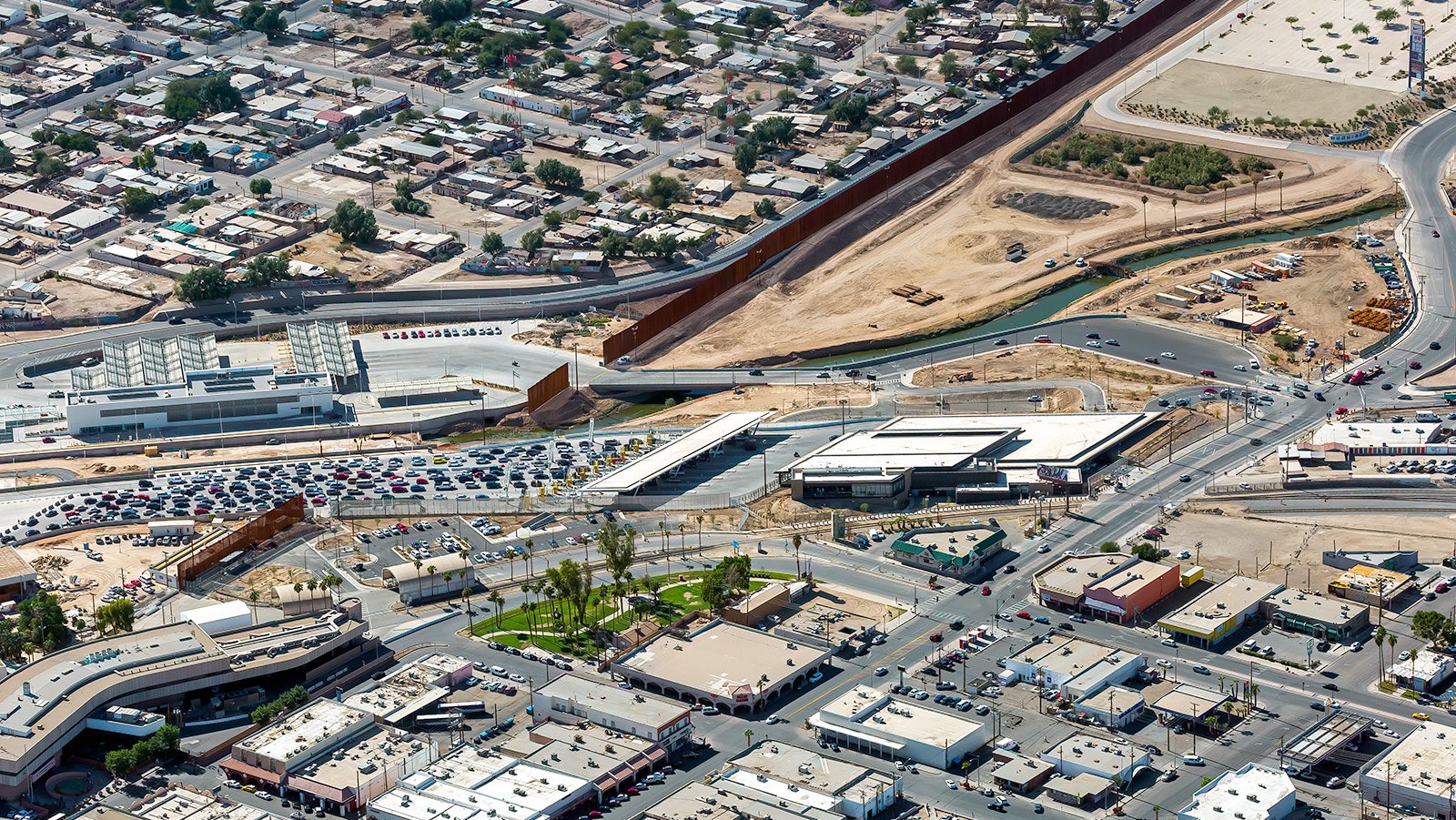
An endless line of cars and trucks in Mexico, patiently waiting to enter the United States at the Calexico West Port of Entry.
Whether you're seeking to track your construction project's development or need stunning photographs capturing the unique beauty of Calexico, aerial photography is your solution! With aerial photography, you can expect unbeatable views of any landscape or urban environment. For top-tier aerial photography services in Calexico, rely on our experts at West Coast Aerial Photography!
Get in Touch Today
From sunrise over the Gran Plaza Outlets to the serene desert landscapes, we strive to encapsulate the unique charm and spirit of Calexico in every photograph. Get in contact with us today and let us capture your vision from the skies!