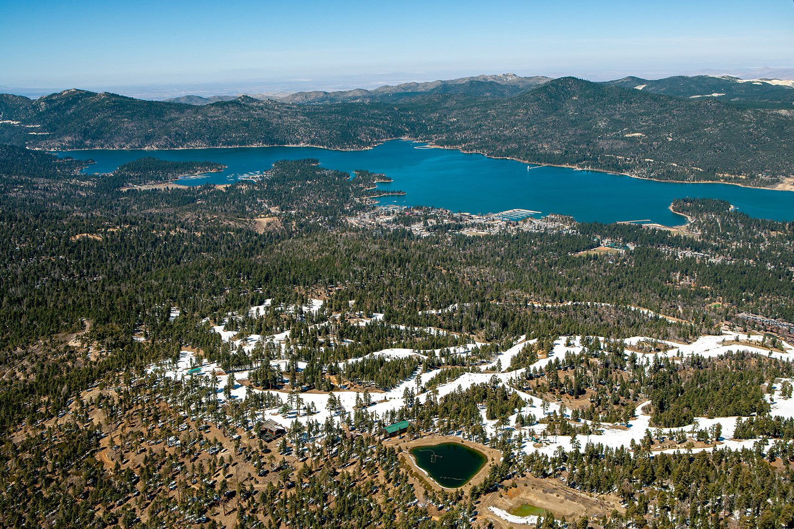
Nestled in the heart of the San Bernardino National Forest, Big Bear boasts a vibrant blend of natural beauty and small-town charm. From the snow-capped peaks to the tranquil waters of Big Bear Lake, the aerial perspective offers a unique storytelling platform.
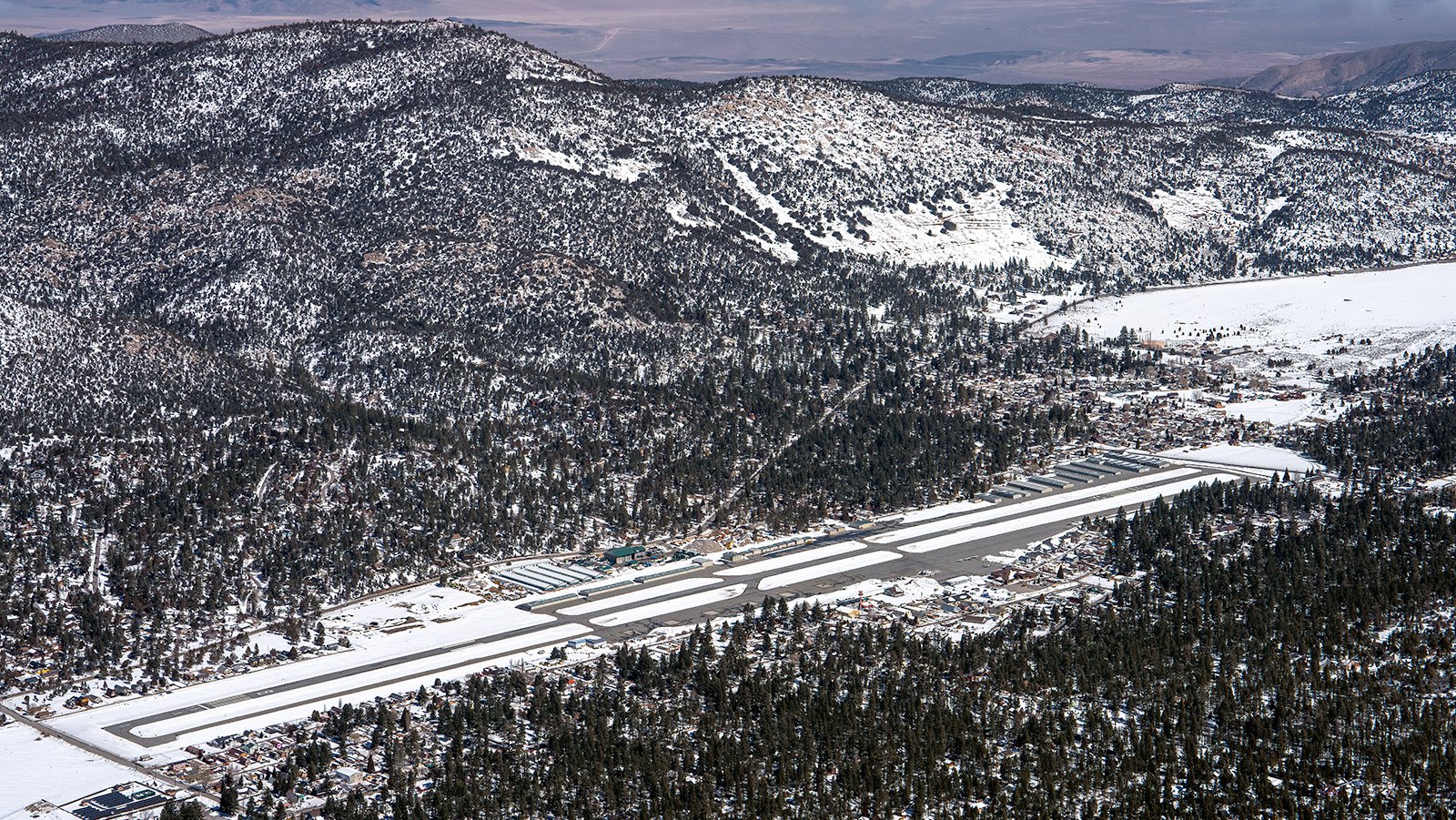
Aerial view of Big Bear Airport, located in the San Bernardino Mountains of Southern California, blanketed in a thick layer of snow during the winter months.
What is Aerial Photography?
Aerial photography is the art of capturing images from an elevated viewpoint, typically from an aircraft. This type of photography yields distinctive perspectives that are unattainable through conventional ground-level photography. Aerial photographers utilize different types of aircraft to capture stunning views of landscapes, towns, landmarks, and more, which are useful in various sectors such as advertising, real estate, and marketing, providing boundless creative opportunities.
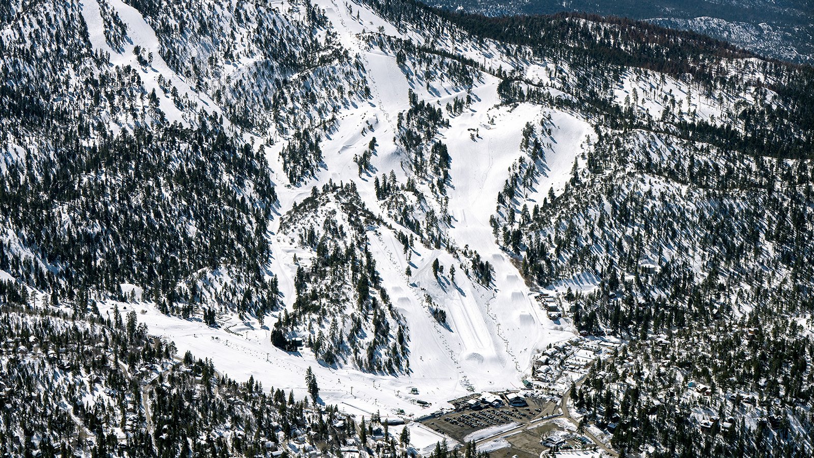
Bear Mountain ski resort, located by Big Bear Lake and part of Big Bear Mountain Resort, boasts three main peaks, one of few Superpipes in Southern California, and tree runs open for skiing and snowboarding
The Benefits of Aerial Photography in Big Bear
Big Bear offers an assortment of picturesque scenery and landmarks. From the Big Bear Mountain Resort to the tranquil Big Bear Lake, there's a wealth of stunning visuals to capture through aerial photography. Whether you're aiming to showcase your real estate property or documenting a mountainous adventure, aerial photography provides the perfect solution.
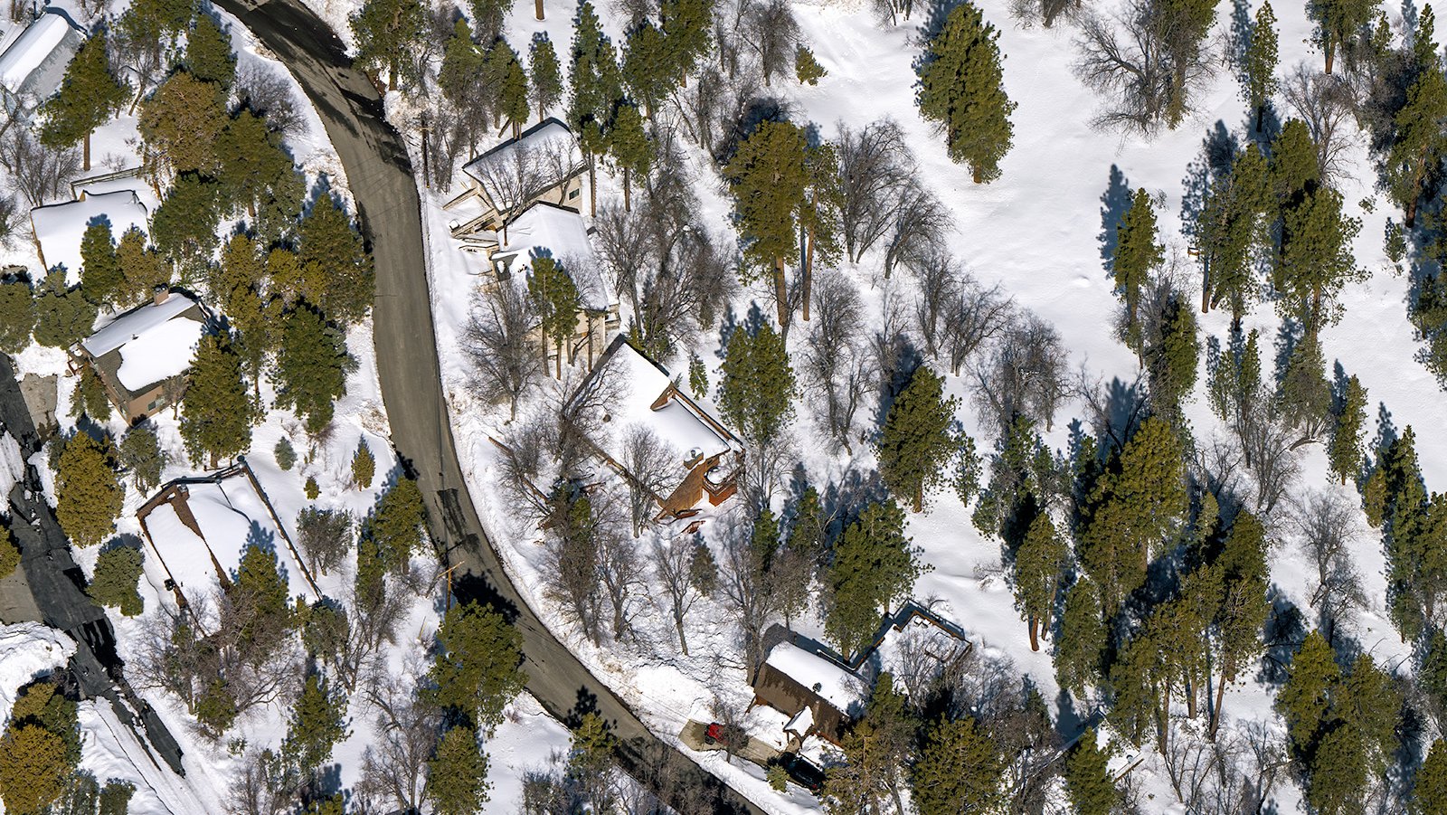
Aerial photo of a serene winter wonderland in Big Bear, California, with cozy homes nestled amongst everygreen trees and a pristine white landscape.
Marketing Real Estate
Real estate agents can leverage aerial photos to market residential or commercial properties up for sale or lease in Big Bear. Aerial images offer potential buyers a comprehensive overview of the property and the surrounding landscapes, which can be particularly beneficial for properties spanning large areas, where ground photos might not fully capture the scope.
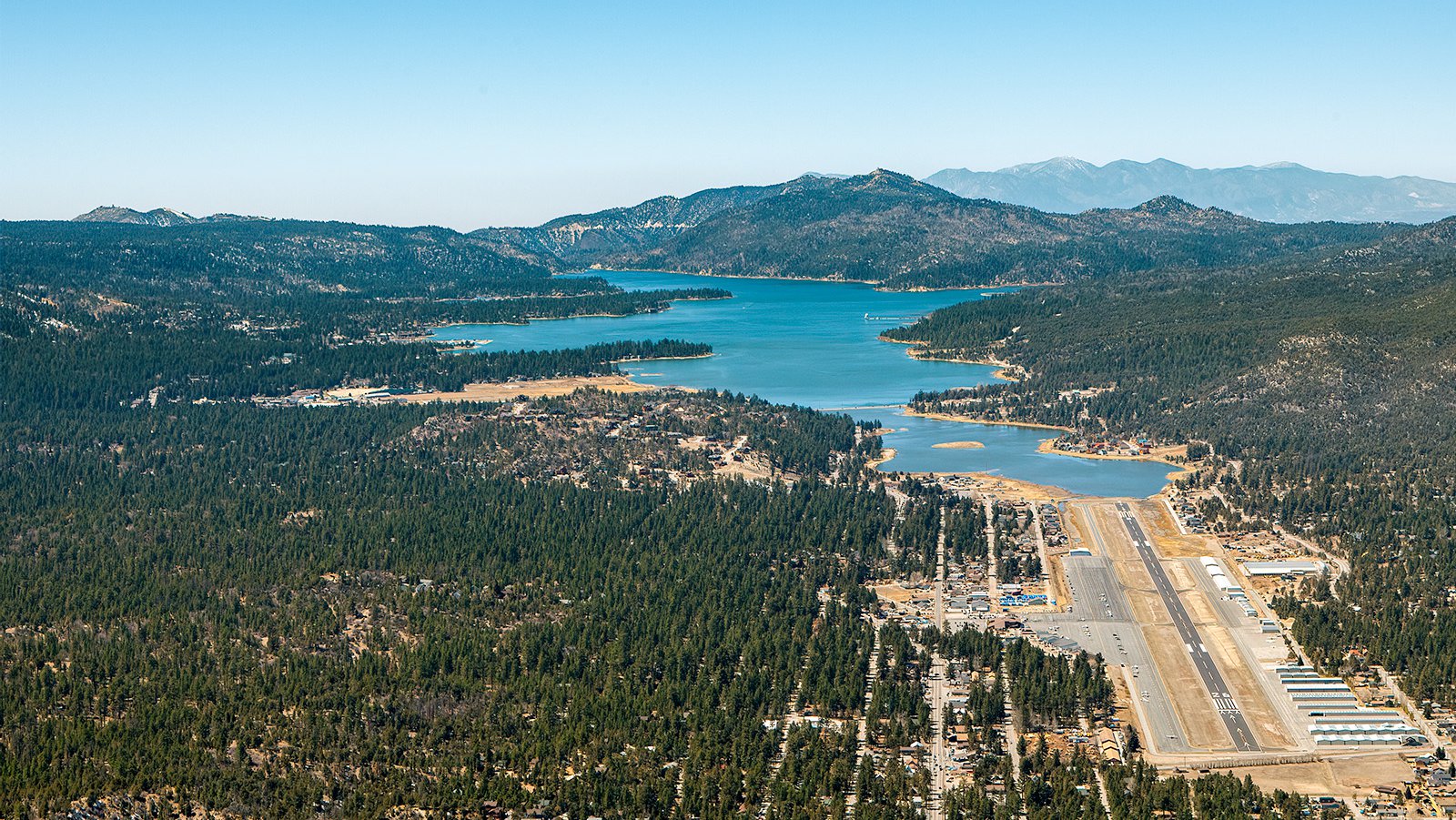
Aerial view of Big Bear Airport framed by Big Bear Lake and surrounded by the communities of Big Bear Lake and Big Bear City.
Monitoring Progress on Construction Projects
Aerial photography is also extremely useful for tracking progress on large-scale construction projects such as ski resorts, housing developments, or commercial buildings. Regularly scheduled aerial shoots provide contractors and developers with an efficient way to monitor and record the construction progress, saving time and money, while also providing a precise representation of project development over time.
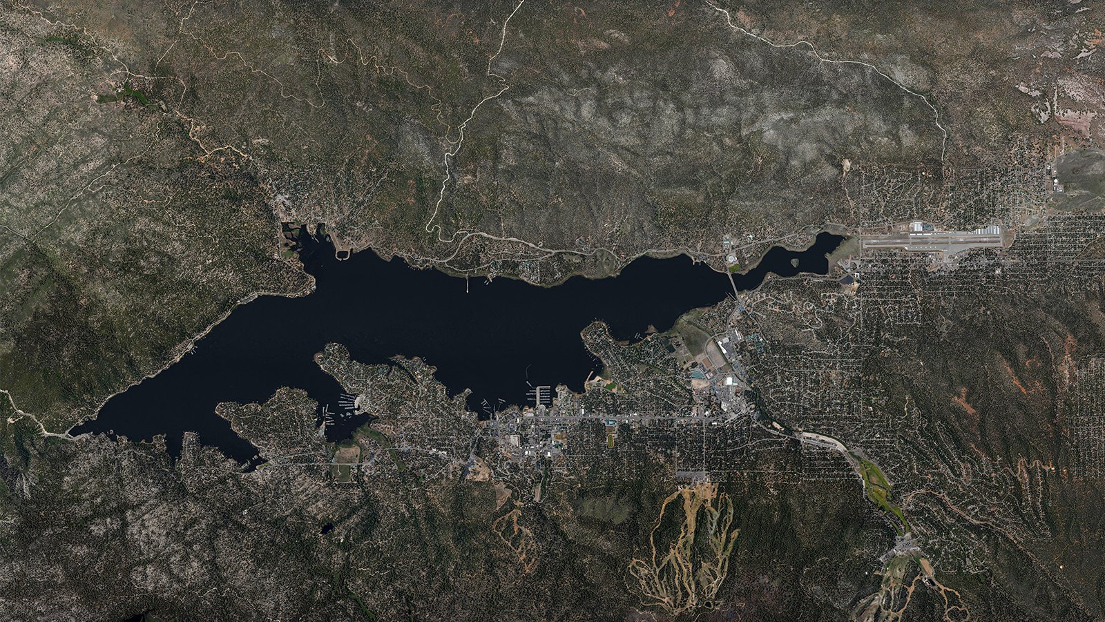
Orthophoto of Big Bear, California provides a precise and georeferenced representation of the area, allowing for accurate analysis and planning of land use, environmental monitoring, and emergency response operations.
Mapping Entire Neighborhoods
Apart from aesthetic appeal, aerial photography also offers practical benefits. Using aircraft equipped with high-resolution cameras, large areas can be surveyed quickly, providing precise, high-resolution imagery for GIS and CAD purposes. These aerial maps can be utilized for planning or generating leads for contractors.
Whether you're hoping to track the progress of your construction project or you're after captivating photographs of the unique beauty of Big Bear, aerial photography is your best bet! For top-quality aerial photography services in Big Bear, California your search ends with us, at West Coast Aerial Photography!
Get in Touch Today
From breathtaking photographs of the serene Big Bear Lake to majestic aerial shots of the San Bernardino Mountains, we strive to encapsulate the unique character of Big Bear in every image we capture.