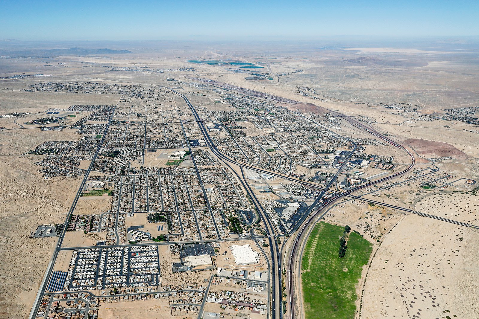
Welcome to the realm of breathtaking aerial photography in Barstow, California. This unique desert city, with its characteristic landscapes and iconic landmarks – such as the historic Harvey House, the Route 66 "Mother Road" Museum, and the expansive Mojave National Preserve – can be more fully appreciated from an aerial viewpoint.
What is Aerial Photography?
Aerial photography is an art form that leverages a bird's eye perspective, often captured from an aircraft. This exciting branch of photography offers a unique perspective that cannot be achieved through regular ground-based photography. Aerial photographers have the ability to capture stunning images of cities, landscapes, and monuments from above, which can be used in various applications including advertising, real estate, and construction monitoring.
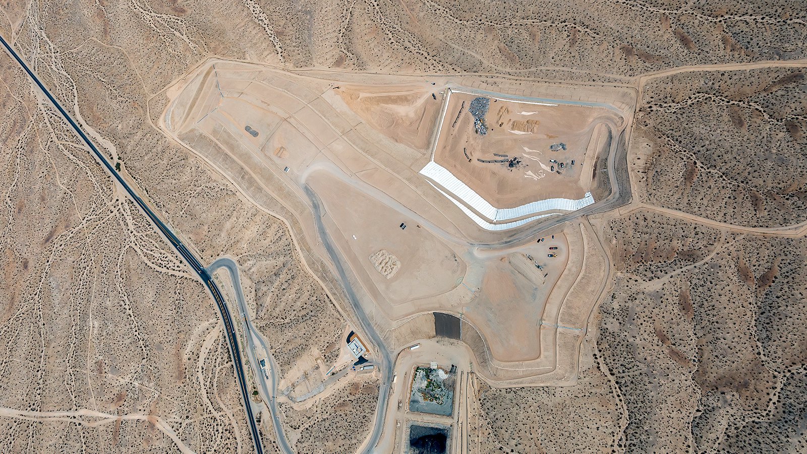
Aerial view of Barstow Landfill, located in San Bernardino County, California, which serves as the main solid waste disposal facility for the city of Barstow and surrounding areas
The Benefits of Aerial Photography in Barstow
Barstow, nestled at the junction of Interstates 15 and 40, is surrounded by vast desert landscapes, vintage architecture, and significant historic sites. Aerial photography can effectively capture the charm of this desert city, whether it's for marketing a piece of real estate, tracking the progress of a construction project, or getting a comprehensive view of an area for planning.
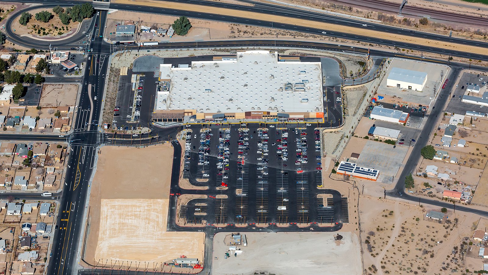
Oblique bird's eye view of a recently constructed Walmart in Barstow, California, features a striking contrast between the large, light building and the uniformly dark, asphalt parking lot.
Marketing Real Estate
For real estate agents, aerial photographs can be a game-changer. Offering a unique view of a property and its surrounding environment, these images can provide potential buyers and renters with an overview of the property's location, its proximity to local amenities, and the general feel of the neighborhood. Aerial photography can be especially beneficial when marketing larger properties where ground-based shots may fail to capture the entirety of the location.
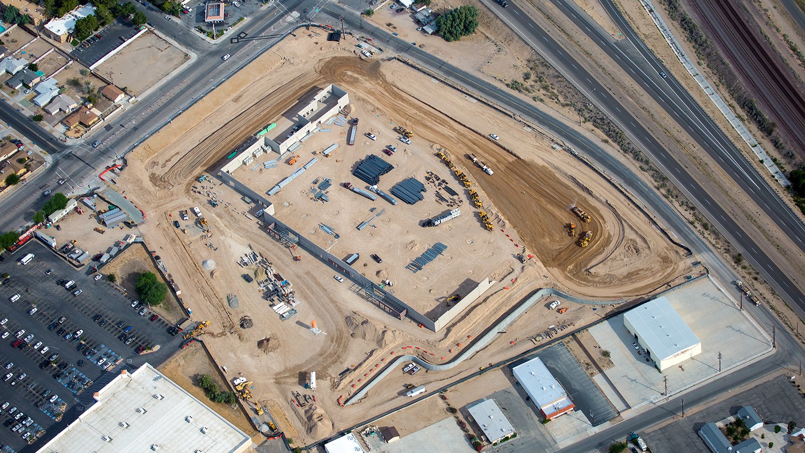
Aerial photo of ongoing construction of an expansive commercial building in Barstow, California, showing a skeleton outline of the strructure taking shape.
Monitoring Progress on Construction Projects
Aerial photography also serves a critical role in monitoring the progress of construction projects. Whether it's a new shopping complex or a housing development, regular aerial photography sessions can provide contractors and developers with a cost-effective and time-saving method of tracking their project's development. These photographs can also serve as historical records for future reference or insurance purposes.
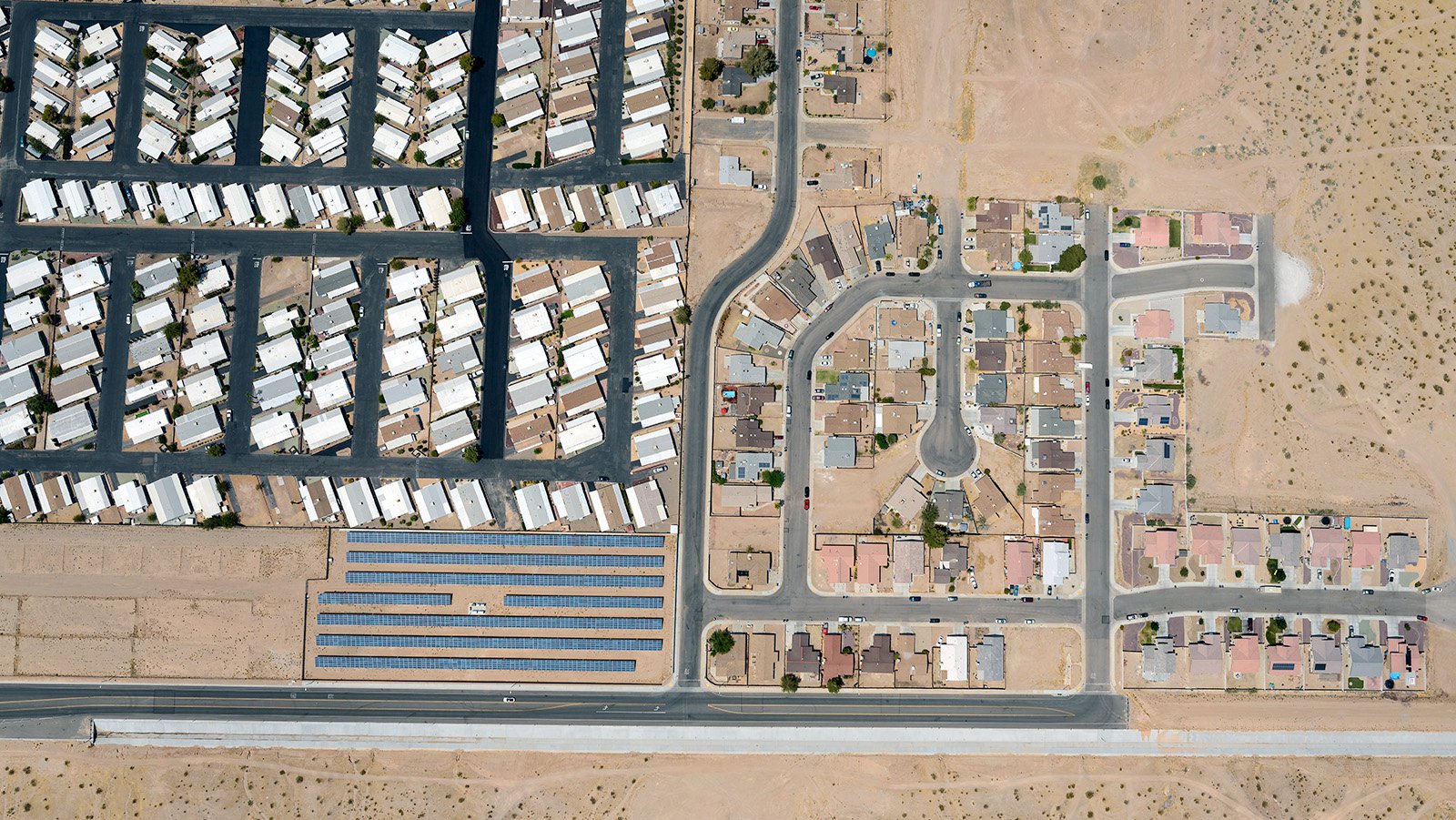
Vertical aerial photo of a small residential community, adjacent to the Holiday Homes Mobile Home Park in Barstow, California, comprising of numerous single-family houses and neatly aligned streets amidst the sprawling desert landscape.
Mapping Entire Neighborhoods
Beyond capturing beautiful visuals, aerial photography has a practical side as well. High-resolution cameras mounted on aircraft can cover large areas accurately, providing valuable data for GIS and CAD applications. These aerial maps can be used by urban planners, or local businesses — like solar panel installers or roofing contractors — who can identify potential leads from these comprehensive views.
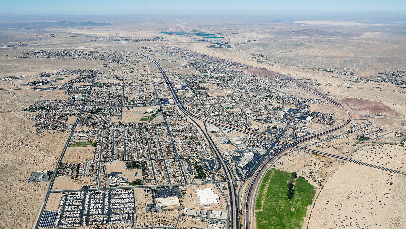
Aerial cityscape of Barstow, California shows its location along the historic Route 66, the presence of the Mojave River, and the notable landmarks such as the Barstow Community College and the historic Harvey House.
From tracking construction progress to capturing the unique beauty of the Barstow desert landscape, aerial photography offers a myriad of possibilities. If it's unrivaled aerial photography service you require in Barstow, you can trust our experienced team at West Coast Aerial Photography!
Get in Touch Today
Our mission is to encapsulate the spirit and character of Barstow in every photograph we take, from the stunning desert sunsets to the historic Route 66 landmarks. Reach out to us today for your aerial photography needs in Barstow, California!