Atascadero, nestled in California’s Central Coast, boasts of diverse landscapes ranging from flourishing vineyards to the picturesque Morro Bay. See the hidden beauty of Atascadero through the unique perspective of aerial photography.
What is Aerial Photography?
Aerial photography is a specialized field that involves capturing photos from a high vantage point, typically from an aircraft. This unique approach allows us to capture images that are impossible from the ground level, presenting landscapes, cities, or landmarks from a fresh angle. Aerial photography is a powerful tool in advertising, real estate, and many other industries, providing limitless creativity.
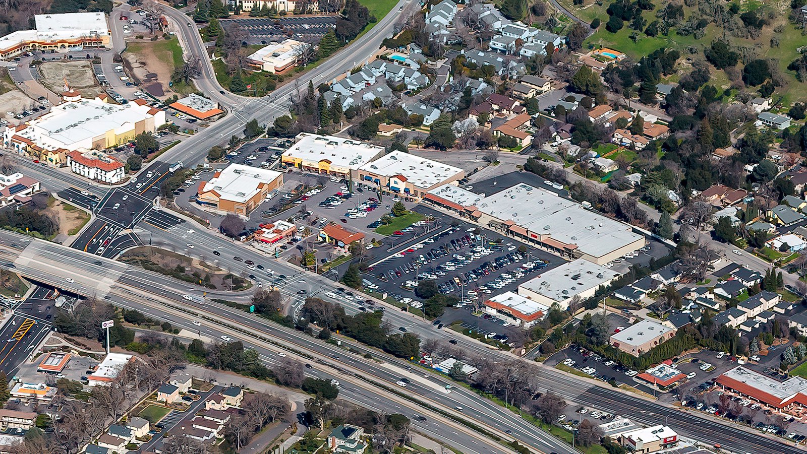
Aerial view of a bustling shopping center in Atascadero, California, featuring a variety of retail stores and restaurants.
The Benefits of Aerial Photography in Atascadero
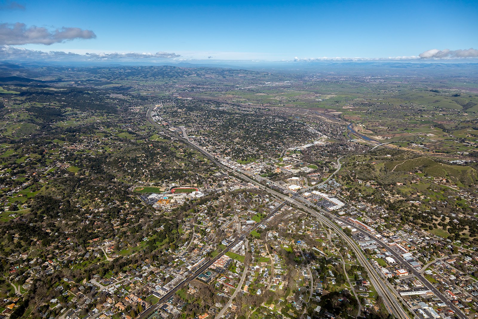
Atascadero has a wealth of stunning locations waiting to be captured from above. From the heart of Atascadero downtown to the idyllic Chalk Mountain Golf Course, there is an abundance of awe-inspiring sights that only aerial photography can do justice. Whether you want to highlight your property for potential buyers or document a construction project from a unique standpoint, aerial photography offers an excellent solution.
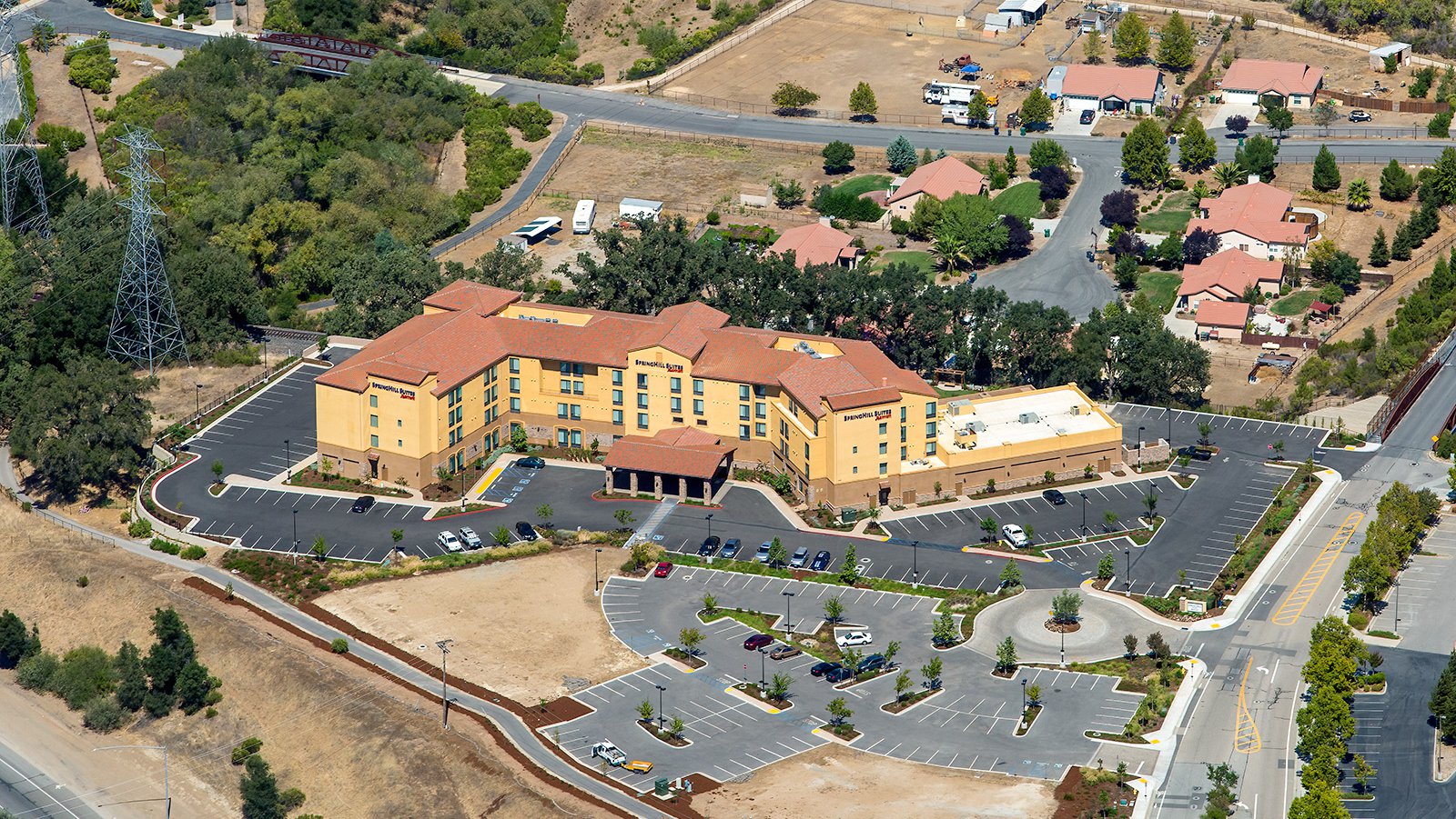
SpringHill Suites Paso Robles Atascadero is located in the heart of California's Central Coast wine country, and is close to nearby attractions such as Cal Poly San Luis Obispo and the renowned Hearst Castle.
Marketing Real Estate
For real estate agents, aerial photographs can take their marketing strategies to new heights. Showcase your listed properties in Atascadero, whether residential or commercial, from an entirely unique perspective. Aerial photos provide a comprehensive view of large properties and their surrounding areas, giving potential buyers a clear picture that isn't possible with ground-level photos.
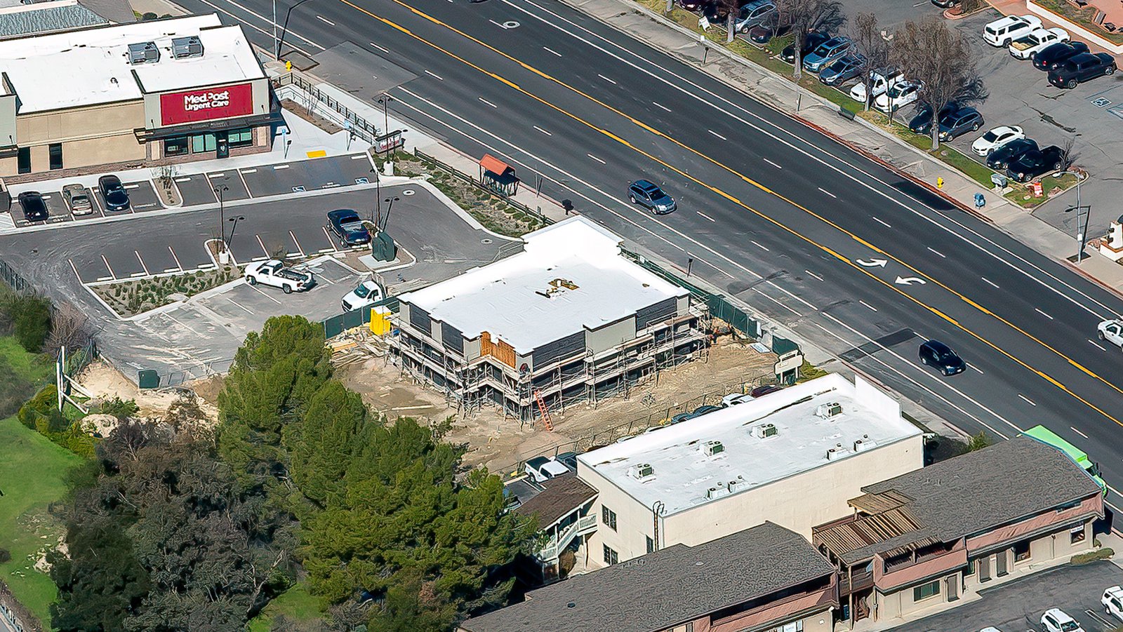
Close-up aerial view showing the construction progress of an multi-story apartment building in Atascadero, California
Monitoring the Progress on Construction Projects
Aerial photography is an outstanding tool for tracking large-scale construction projects. Regular aerial shoots can help contractors and developers monitor their work effectively. This method saves both time and money, while providing an accurate record of the project’s development. Moreover, these images can also serve as legal documentation for insurance purposes.
Mapping Entire Neighborhoods
Beyond its aesthetic appeal, aerial photography also facilitates practical applications. With the aid of high-resolution cameras mounted on aircraft, large areas can be surveyed efficiently, generating high-definition imagery for GIS and CAD applications. These aerial maps are invaluable for planning purposes or to identify potential leads, such as spotting roofs in need of repair.
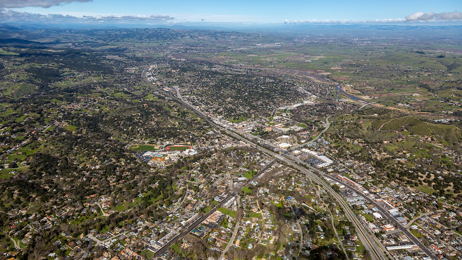
Bird's eye view of Atascadero, California, showing its bustling downtown and the idyllic surrounding rolling hills and vineyards of the Central Coast.
From monitoring construction progress to capturing the serene landscapes of Atascadero, aerial photography is a versatile solution. Experience the unparalleled views of Atascadero’s landscapes, from the Charles Paddock Zoo to the tranquil Sunken Gardens, with us at West Coast Aerial Photography!
Get in Touch Today
We aim to encapsulate the unique charm and spirit of Atascadero in every photograph we capture. From stunning aerial shots of Atascadero Lake Park to the scenic beauty of Stadium Park, we are committed to delivering top-tier aerial photography services in Atascadero.