"Caltrans we have a problem!"
On November 20, 2011, a massive landslide occurred at White Point in the San Pedro area of Los Angeles. Approximately 420 feet of Paseo Del Mar slid 53 feet southward toward the ocean. Aerial photography can be used to help understand the White Point landslide by providing visual data from a bird’s eye view.
What Caused the White Point Landslide?
The primary cause of the White Point landslide was heavy rains that had soaked the coastal bluff for weeks before. The combination of water saturation and soil instability caused a massive failure in the hillside, resulting in a large section of land sliding off the Southern California coastal cliff face.
How Was the White Point Landslide Responded To?
When news about this rare natural disaster spread throughout Los Angeles, there was raised concern about what kind of damage had been done. There were several emergency response teams sent out to assess the potential damages done by the landslide, as well as investigate whether or not any human negligence played a role in its occurrence. All parties involved agreed that immediate action needed to be taken to prevent any further damage or future landslides. Engineers were brought out to design protective walls along Paseo Del Mar to mitigate future landslides from happening again, as well as ways to divert rainwater away from these areas so that surface runoff does not cause further instabilities beneath soil layers already weakened due to seismic activity.
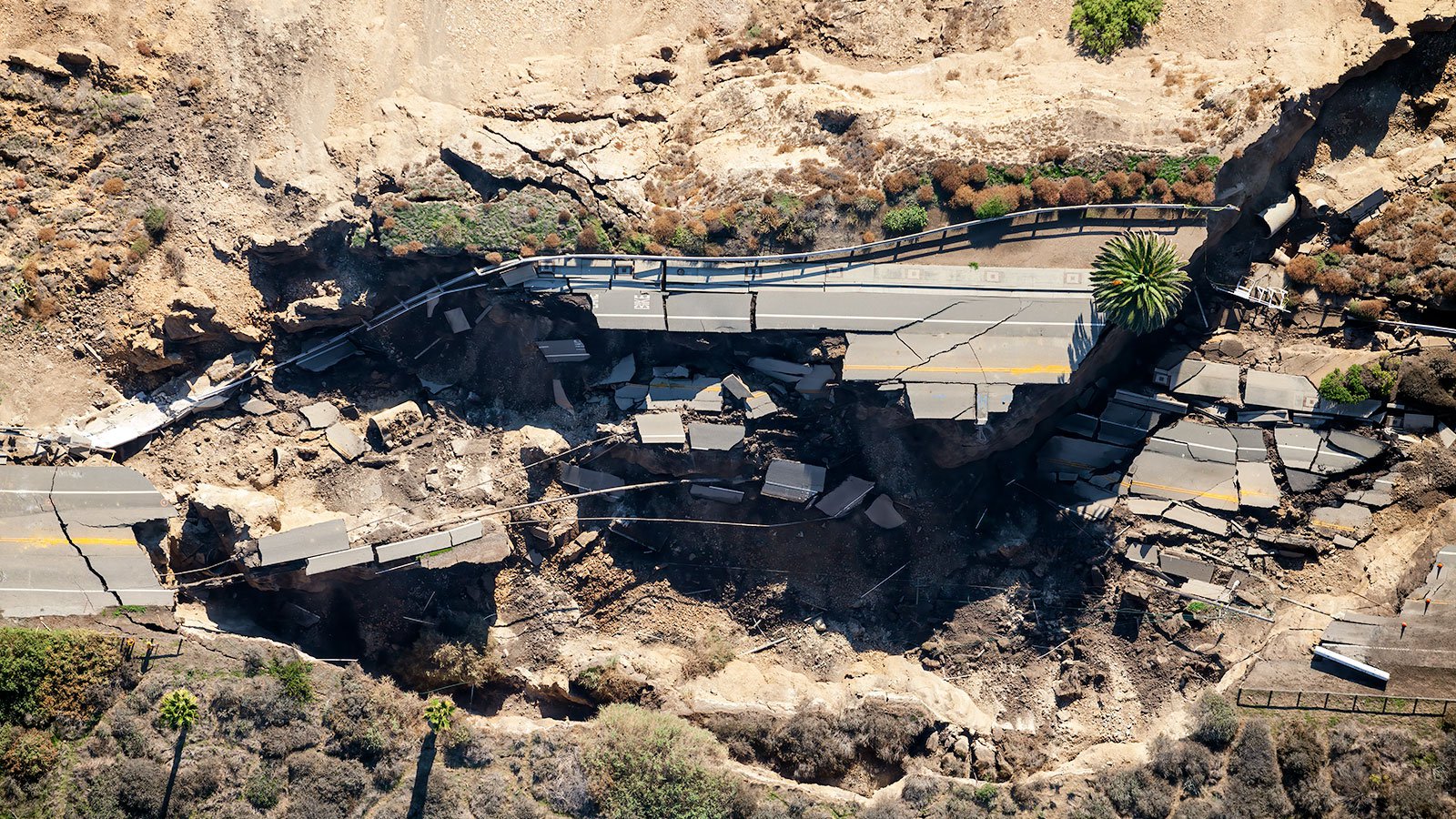
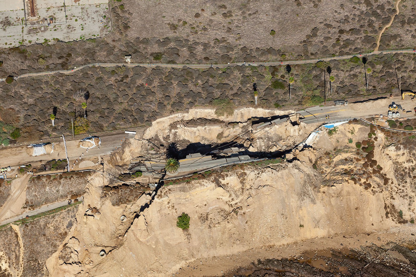
A vertical aerial view of the Paseo Del Mar road that was severely damaged in the White Point Landslide, illustrating the powerful, destructive forces of nature.
The Landslide's Impact on Local Infrastructure
The White Point landslide caused significant damage to local infrastructure, the largest being a portion of Paseo Del Mar that was permanently closed. These closures led local officials to reroute traffic away from this section of the road and onto other nearby streets until repairs could be completed.
Witnessing the White Point Landslide From Above
Aerial photographs taken after the landslide show just how dramatic the effects were. The movement of dirt and debris can be seen stretching out across 200 linear feet along with massive fissures that cut through Paseo Del Mar, which was completely severed.
Aerial Photography as an Aid
Aerial photography is an incredibly useful tool for understanding landslides like the one at White Point. By using aerial photography to identify areas where landslides may occur, scientists can better predict future occurrences and help prevent them from occurring. Aerial photographs can also be used to monitor changes in land surfaces over time and document landslide activity. This type of data helps us better understand our environment and leads to improved land use planning in areas prone to landslides. It can also be used to assess damage after natural disasters occur so that resources can be allocated more effectively for clean-up operations and reconstruction efforts.
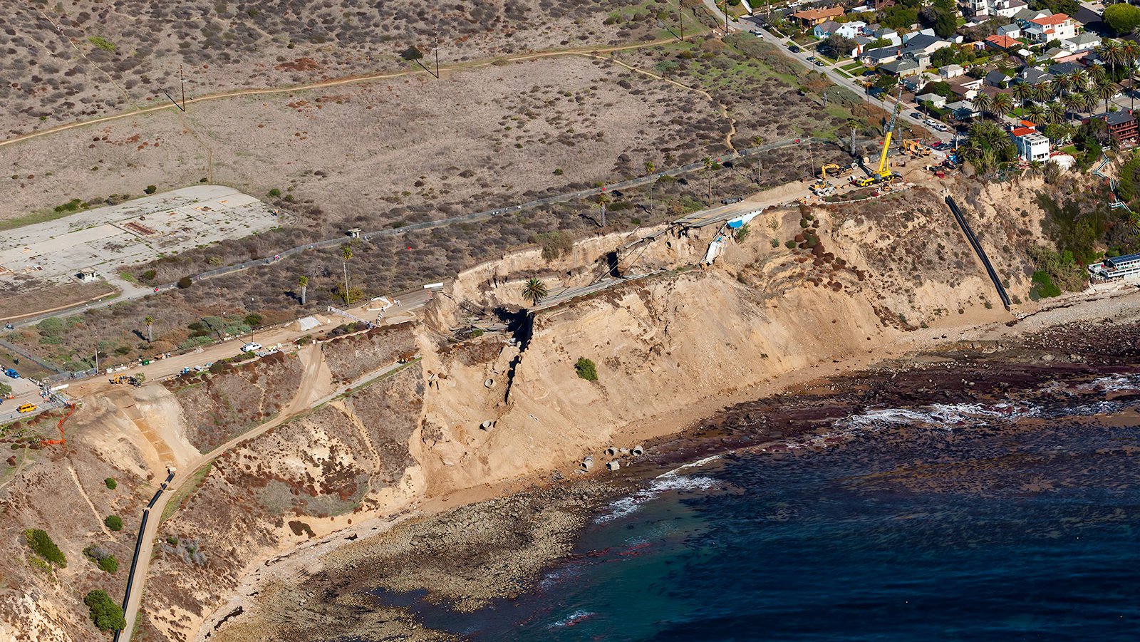
An expansive aerial view of Paseo del Mar, the road stretching from San Pedro to Palos Verdes, reveals a dramatic scene as its cliffside terrain collapses into the Pacific Ocean as a result of the White Point Landslide, leaving behind a jagged and fragmented road.
The White Point Landslide serves as an important reminder that natural disasters such as landslides, while unpredictable, are very much real threats - especially if you live in areas prone to landslides! Thankfully, there are ways we can better prepare ourselves considering these types of events occur by utilizing technology, like aerial photography, so that we can better identify potential hazards before they become reality.